Olendon | |
|---|---|
) Fallen menhir | |
Location of Olendon 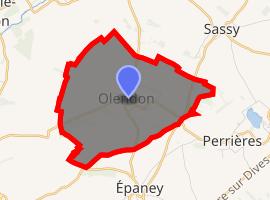 | |
) Olendon ) Olendon | |
| Coordinates: 48°58′11″N 0°10′12″W / 48.9697°N 0.17°W | |
| Country | France |
| Region | Normandy |
| Department | Calvados |
| Arrondissement | Caen |
| Canton | Falaise |
| Intercommunality | Pays de Falaise |
| Government | |
| • Mayor (2008–2014) | Norbert Blais |
| Area 1 | 7.45 km2 (2.88 sq mi) |
| Population (Jan. 2017)[1] | 184 |
| • Density | 25/km2 (64/sq mi) |
| Time zone | UTC+01:00 (CET) |
| • Summer (DST) | UTC+02:00 (CEST) |
| INSEE/Postal code | 14476 /14170 |
| Elevation | 81–170 m (266–558 ft) (avg. 206 m or 676 ft) |
| 1 French Land Register data, which excludes lakes, ponds, glaciers > 1 km2 (0.386 sq mi or 247 acres) and river estuaries. | |
Olendon is a commune in the Calvados department in the Normandy region in northwestern France.
Population
| Year | Pop. | ±% |
|---|---|---|
| 1962 | 176 | — |
| 1968 | 160 | −9.1% |
| 1975 | 147 | −8.1% |
| 1982 | 174 | +18.4% |
| 1990 | 185 | +6.3% |
| 1999 | 168 | −9.2% |
| 2008 | 186 | +10.7% |
See also
References
- ^ "Populations légales 2017". INSEE. Retrieved 6 January 2020.