Noyelles-lès-Humières | |
|---|---|
) The church of Noyelles-lès-Humières | |
) Coat of arms | |
Location of Noyelles-lès-Humières 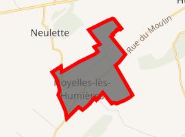 | |
) Noyelles-lès-Humières ) Noyelles-lès-Humières | |
| Coordinates: 50°22′28″N 2°10′36″E / 50.3744°N 2.1767°E | |
| Country | France |
| Region | Hauts-de-France |
| Department | Pas-de-Calais |
| Arrondissement | Montreuil |
| Canton | Auxi-le-Château |
| Intercommunality | CC Sept Vallées |
| Government | |
| • Mayor (2020–2026) | Jean-Claude Louchet[1] |
| Area 1 | 1.16 km2 (0.45 sq mi) |
| Population (Jan. 2017)[2] | 53 |
| • Density | 46/km2 (120/sq mi) |
| Time zone | UTC+01:00 (CET) |
| • Summer (DST) | UTC+02:00 (CEST) |
| INSEE/Postal code | 62625 /62770 |
| Elevation | 95–112 m (312–367 ft) (avg. 109 m or 358 ft) |
| 1 French Land Register data, which excludes lakes, ponds, glaciers > 1 km2 (0.386 sq mi or 247 acres) and river estuaries. | |
Noyelles-lès-Humières is a commune in the Pas-de-Calais department in the Hauts-de-France region of France.
Geography
Noyelles-lès-Humières lies about 20 miles (32 km) southeast of Montreuil-sur-Mer, on the D106 and D98 road junction.
Population
| Year | Pop. | ±% p.a. |
|---|---|---|
| 1968 | 61 | — |
| 1975 | 50 | −2.80% |
| 1982 | 46 | −1.18% |
| 1990 | 57 | +2.72% |
| 1999 | 56 | −0.20% |
| 2007 | 66 | +2.08% |
| 2012 | 57 | −2.89% |
| 2017 | 53 | −1.44% |
| Source: INSEE[3] | ||
Places of interest
- The seventeenth century church of St. Martin.
See also
References
- ^ "Répertoire national des élus: les maires". data.gouv.fr, Plateforme ouverte des données publiques françaises (in French). 2 December 2020. Retrieved 7 December 2020.
- ^ "Populations légales 2017". INSEE. Retrieved 6 January 2020.
- ^ Population en historique depuis 1968, INSEE
Notes
- This article is based on the equivalent article from the French Wikipedia, consulted 25 April 2008.