Noyant-la-Gravoyère | |
|---|---|
Part of Segré-en-Anjou Bleu | |
Location of Noyant-la-Gravoyère 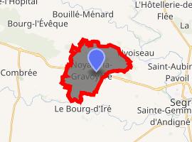 | |
) Noyant-la-Gravoyère ) Noyant-la-Gravoyère | |
| Coordinates: 47°42′17″N 0°57′14″W / 47.7047°N 0.9539°W | |
| Country | France |
| Region | Pays de la Loire |
| Department | Maine-et-Loire |
| Arrondissement | Segré |
| Canton | Segré |
| Commune | Segré-en-Anjou Bleu |
| Area 1 | 11.91 km2 (4.60 sq mi) |
| Population (2017)[1] | 1,849 |
| • Density | 160/km2 (400/sq mi) |
| Time zone | UTC+01:00 (CET) |
| • Summer (DST) | UTC+02:00 (CEST) |
| Postal code | 49520 |
| Elevation | 32–102 m (105–335 ft) (avg. 97 m or 318 ft) |
| 1 French Land Register data, which excludes lakes, ponds, glaciers > 1 km2 (0.386 sq mi or 247 acres) and river estuaries. | |
Noyant-la-Gravoyère is a former commune in the Maine-et-Loire department in western France. On 15 December 2016, it was merged into the new commune Segré-en-Anjou Bleu.[2] Its population was 1,849 in 2017,[1] down from 1,961 in 1962.
Geography
The river Verzée forms part of the commune's southern border.
See also
References
- ^ a b Téléchargement du fichier d'ensemble des populations légales en 2017, INSEE
- ^ Arrêté préfectoral 28 September 2016 (in French)