Muncho Lake | |
|---|---|
| Coordinates: 58°56′17″N 125°46′03″W / 58.93806°N 125.76750°W | |
| Country | Canada |
| Province | British Columbia |
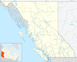
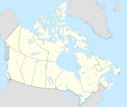
Muncho Lake is a highway services community in northern British Columbia, Canada, located at Mile 462 on Highway 97, the Alaska Highway, within Muncho Lake Provincial Park and on the south end of the lake of the same name.[1] The community consists almost entirely of travel and tourism-related businesses such as lodging, game outfitting, restaurants, gas stations and fishing outfitting.
Climate
| Climate data for Muncho Lake | |||||||||||||
|---|---|---|---|---|---|---|---|---|---|---|---|---|---|
| Month | Jan | Feb | Mar | Apr | May | Jun | Jul | Aug | Sep | Oct | Nov | Dec | Year |
| Record high °C (°F) | 10.5 (50.9) | 15.0 (59.0) | 15.0 (59.0) | 23.9 (75.0) | 34.0 (93.2) | 32.5 (90.5) | 34.0 (93.2) | 32.8 (91.0) | 30.5 (86.9) | 25.5 (77.9) | 13.3 (55.9) | 13.0 (55.4) | 34.0 (93.2) |
| Average high °C (°F) | −8.9 (16.0) | −5.5 (22.1) | −0.3 (31.5) | 7.9 (46.2) | 14.0 (57.2) | 18.9 (66.0) | 20.5 (68.9) | 19.1 (66.4) | 13.5 (56.3) | 6.1 (43.0) | −4.1 (24.6) | −6.4 (20.5) | 6.2 (43.2) |
| Daily mean °C (°F) | −14.1 (6.6) | −11.5 (11.3) | −6.9 (19.6) | 1.5 (34.7) | 7.2 (45.0) | 12.1 (53.8) | 14.1 (57.4) | 12.7 (54.9) | 7.9 (46.2) | 1.4 (34.5) | −8.6 (16.5) | −11.2 (11.8) | 0.4 (32.7) |
| Average low °C (°F) | −19.2 (−2.6) | −17.5 (0.5) | −13.4 (7.9) | −5.0 (23.0) | 0.4 (32.7) | 5.3 (41.5) | 7.6 (45.7) | 6.2 (43.2) | 2.2 (36.0) | −3.3 (26.1) | −13.1 (8.4) | −16.0 (3.2) | −5.5 (22.1) |
| Record low °C (°F) | −50.4 (−58.7) | −45.0 (−49.0) | −40.0 (−40.0) | −29.0 (−20.2) | −18.0 (−0.4) | −3.5 (25.7) | −0.6 (30.9) | −5.0 (23.0) | −12.8 (9.0) | −32.5 (−26.5) | −40.0 (−40.0) | −48.0 (−54.4) | −50.4 (−58.7) |
| Average precipitation mm (inches) | 38.4 (1.51) | 25.9 (1.02) | 19.0 (0.75) | 17.4 (0.69) | 43.8 (1.72) | 63.3 (2.49) | 92.1 (3.63) | 71.4 (2.81) | 45.0 (1.77) | 36.6 (1.44) | 31.5 (1.24) | 28.0 (1.10) | 512.3 (20.17) |
| Average rainfall mm (inches) | 0.5 (0.02) | 0.3 (0.01) | 0.3 (0.01) | 5.4 (0.21) | 37.8 (1.49) | 62.8 (2.47) | 92.1 (3.63) | 71.0 (2.80) | 43.1 (1.70) | 17.6 (0.69) | 2.1 (0.08) | 0.4 (0.02) | 333.3 (13.12) |
| Average snowfall cm (inches) | 38.0 (15.0) | 25.6 (10.1) | 18.6 (7.3) | 12.0 (4.7) | 6.0 (2.4) | 0.5 (0.2) | 0 (0) | 0.4 (0.2) | 1.9 (0.7) | 18.9 (7.4) | 29.4 (11.6) | 27.6 (10.9) | 179.0 (70.5) |
| Average precipitation days | 10.1 | 8.1 | 6.5 | 6.4 | 13.3 | 16.2 | 20.7 | 17.3 | 16.0 | 13.5 | 11.4 | 8.8 | 148.3 |
| Average rainy days | 0.31 | 0.12 | 0.15 | 2.6 | 12.6 | 16.2 | 20.7 | 17.3 | 15.6 | 8.4 | 0.96 | 0.21 | 95.2 |
| Average snowy days | 9.9 | 8.0 | 6.3 | 4.4 | 1.2 | 0.12 | 0 | 0.15 | 0.81 | 6.2 | 10.8 | 8.5 | 56.2 |
| Source: Environment Canada[2] | |||||||||||||
See also
- Muncho Pass
- Sentinel Range (Canada)
References
- ^ "Muncho Lake (locality)". BC Geographical Names.
- ^ Environment Canada—1981–2010, accessed 21 October 2017

