Mszczonów | |
|---|---|
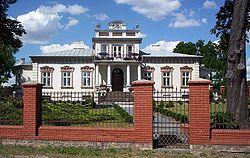
 19th century manor in Mszczonów | |
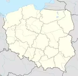
| Coordinates: 51°58′27″N 20°31′36″E / 51.97417°N 20.52667°E | |
| Country | |
| Voivodeship | Masovian |
| County | Żyrardów |
| Gmina | Mszczonów |
| Town rights | 1377 |
| Government | |
| • Mayor | Józef Grzegorz Kurek |
| Area | |
| • Total | 8.56 km2 (3.31 sq mi) |
| Population (2006) | |
| • Total | 6,231 |
| • Density | 730/km2 (1,900/sq mi) |
| Time zone | UTC+1 (CET) |
| • Summer (DST) | UTC+2 (CEST) |
| Postal code | 96-320 |
| Area code(s) | +48 46 |
| Car plates | WZY |
| Website | www.mszczonow.pl |
Mszczonów [ˈmʂt͡ʂɔnuf] (Yiddish: אַמשינאָוו Amshinov) is a town in Żyrardów County, Masovian Voivodeship, Poland, with 6,231 inhabitants as of the 2006 census. It is situated just outside the Warsaw metropolitan area, approximately 45km from Warsaw city centre.
The town possessed a vibrant Jewish community, and it was once the center of the Hasidic Amshinov dynasty (Mszczonów being pronounced as "Amshinov" in Yiddish.)
External links
- Jewish Community in Mszczonów on Virtual Shtetl


