| Mount Steere | |
|---|---|
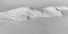
 Mounts Frakes (left) and Steere (right) from the northeast. | |
| Highest point | |
| Elevation | 3,558 m (11,673 ft) |
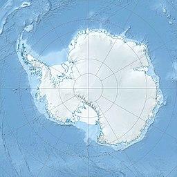
| Coordinates | 76°42′S 117°48′W / 76.7°S 117.8°W |
| Geography | |
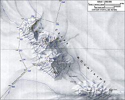
| Parent range | Crary Mountains |
| Geology | |
| Age of rock | Unknown |
| Mountain type | Shield volcano |
| Volcanic field | Marie Byrd Land Volcanic Province |
Mount Steere is a prominent shield volcano standing 6.4 km (4 mi) NNW of Mount Frakes in the Crary Mountains of Marie Byrd Land, Antarctica.
Mapped by USGS from ground surveys and U.S. Navy air photos, 1959–66. Named by US-ACAN for William C. Steere, biologist at McMurdo Station, 1964–65 season.
See also
Sources
- LeMasurier, W. E.; Thomson, J. W., eds. (1990). Volcanoes of the Antarctic Plate and Southern Oceans. American Geophysical Union. p. 512 pp. ISBN 0-87590-172-7.
- "Skiing the Pacific Ring of Fire and Beyond". Amar Andalkar's Ski Mountaineering and Climbing Site. 2007 [1997]. Retrieved 14 January 2005.

