Montroy | |
|---|---|
) The town hall in Montroy | |
Location of Montroy 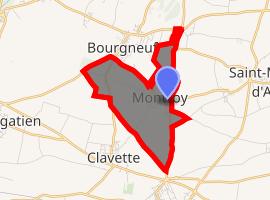 | |
) Montroy ) Montroy | |
| Coordinates: 46°09′18″N 1°04′37″W / 46.155°N 1.077°W | |
| Country | France |
| Region | Nouvelle-Aquitaine |
| Department | Charente-Maritime |
| Arrondissement | La Rochelle |
| Canton | La Jarrie |
| Intercommunality | CA La Rochelle |
| Government | |
| • Mayor (2008–2014) | Corine André |
| Area 1 | 3.99 km2 (1.54 sq mi) |
| Population (Jan. 2017)[1] | 893 |
| • Density | 220/km2 (580/sq mi) |
| Time zone | UTC+01:00 (CET) |
| • Summer (DST) | UTC+02:00 (CEST) |
| INSEE/Postal code | 17245 /17220 |
| Elevation | 25–47 m (82–154 ft) (avg. 47 m or 154 ft) |
| 1 French Land Register data, which excludes lakes, ponds, glaciers > 1 km2 (0.386 sq mi or 247 acres) and river estuaries. | |
Montroy is a commune in the Charente-Maritime in the department in the Nouvelle-Aquitaine region in southwestern France.
Population
| Year | Pop. | ±% |
|---|---|---|
| 1962 | 200 | — |
| 1968 | 210 | +5.0% |
| 1975 | 237 | +12.9% |
| 1982 | 410 | +73.0% |
| 1990 | 486 | +18.5% |
| 1999 | 538 | +10.7% |
| 2008 | 654 | +21.6% |
See also
References
- ^ "Populations légales 2017". INSEE. Retrieved 6 January 2020.