 | |
| Native name | Bóthar Mhuirfean (Irish) |
|---|---|
| Namesake | Merrion Castle, seat of the Viscounts FitzWilliam |
| Length | 2.9 km (1.8 mi) |
| Width | 24 metres (79 ft) |
| Location | Dublin, Ireland |
| Postal code | D04 |
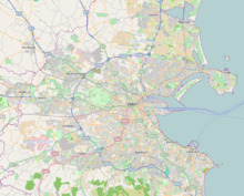
| Coordinates | 53°19′16″N 6°12′59″W / 53.321005°N 6.216309°W |
| north end | Ball's Bridge |
| south end | Rock Road, Trimleston Avenue |
| Other | |
| Known for | St. Vincent's University Hospital, Wanderers F.C., Royal Dublin Society, embassies |
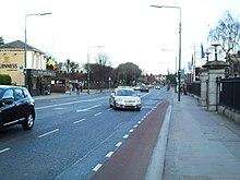
Merrion Road is a major road, part of the R118, in Dublin 4.
It joins the Pembroke Road section of the R118 at Herbert Park and runs south east to Merrion, where it meets the Rock Road, Booterstown.
At Merrion Gates it meets Strand Road (R131) just after the latter crosses the DART line.
There are a number of well-known buildings along Merrion Road. These include the Royal Dublin Society (RDS), the British Embassy, the Merrion Shopping Centre, some well known hotels and part of the Embassy Belt, Ballsbridge. Wanderers F.C. (rugby union) and St. Vincent's University Hospital are also located on the road.
