Wikipedia

List of neighborhoods in Woodbridge Township, New Jersey

(redirected from Menlo Park Terrace, New Jersey)

Woodbridge is a township in Middlesex County, New Jersey. According to the United States Census Bureau, the township had a total land area of including 23.213 square miles (60.122 km2). There are many distinct sections,[1][2][3] many of which are census-designated places (CDPs). Some have their own ZIP Codes.

Sections and neighborhoods

Name Image Coordinate Notes References
Avenel 2018-05-18 15 35 23 View south along New Jersey State Route 35 (Saint George Avenue) at Butler Street in Woodbridge Township, Middlesex County, New Jersey.jpg 40°35′04″N 74°16′18″W / 40.584334°N 74.271626°W Avenel station is located in the neighborhood [2][1]
Boynton Beach 40°32′50″N 74°15′17″W / 40.54722°N 74.25472°W On the Arthur Kill, once the site of amusement park and bathing beach [4][5][1][6]
Colonia 40°35′39″N 74°18′50″W / 40.594133°N 74.31377°W [7][1]
Edgars 40°34′03″N 74°16′33″W / 40.56750°N 74.27583°W [8][1]
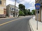
Fords 2018-05-20 13 09 16 View east along Middlesex County Route 501 (King Georges Road) at Amboy Avenue and Middlesex County Route 616 (New Brunswick Avenue) in Woodbridge Township, Middlesex County, New Jersey.jpg 40°32′38″N 74°18′47″W / 40.543794°N 74.31292°W Abuttng Edison, it was originally known as Fords Corner. [9][2][10]
Hazelton 2018-05-18 15 35 23 View south along New Jersey State Route 35 (Saint George Avenue) at Butler Street in Woodbridge Township, Middlesex County, New Jersey.jpg 40°35′18″N 74°17′27″W / 40.58833°N 74.29083°W [11][1]
Hopelawn
Iselin 40°34′09″N 74°19′16″W / 40.569295°N 74.321106°W [12][1]
Keasbey 40°31′00″N 74°18′19″W / 40.51667°N 74.30528°W At the foot of the Driscoll Bridge close to the Raritan River, originally known as Florida Grove, it abuts neighboring Perth Amboy [13][1][14]
Lynn Woodoaks 40°35′20″N 74°20′00″W / 40.58889°N 74.33333°W Along the Garden State Parkway near the Edison border [1]
Menlo Park Terrace 40°33′09″N 74°19′25″W / 40.55250°N 74.32361°W Located off U.S. Route 1 in between Menlo Park Mall and Woodbridge Center at Exit 130 of the Garden State Parkway. Uses Metuchen ZIP code 08840 [1]
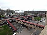
Metropark Metropark Station - April 2015.jpg 40°34′05″N 74°19′47″W / 40.56808°N 74.329795°W Office center built around Metropark station near the interchange of New Jersey Route 27 and Garden State Parkway [1]
Oak Tree Road In Iselin and Edison
Port Reading
Sand Hills 40°31′30″N 74°19′10″W / 40.52500°N 74.31944°W Sand Hills is a neighborhood straddling Woodbridge and adjacent Edison. [15][16][1][17]
Sewaren
Shore View 40°35′25″N 74°19′41″W / 40.59028°N 74.32806°W Along the Garden State Parkway near the Edison border [18][1]
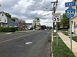
Woodbridge Proper 2018-05-20 17 58 43 View east along Middlesex County Route 514 (Main Street) between Grove Street and Mattison Street in Woodbridge Township, Middlesex County, New Jersey.jpg The original settlement of Woodbridge. Site of Woodbridge Station. [1]
Woodbridge Center 40°33′24″N 74°17′57″W / 40.556666°N 74.299213°W Shopping mall at U.S. Route 1 and U.S. Route 9
Woodbridge Oaks 40°34′57″N 74°20′01″W / 40.58250°N 74.33361°W Along the Garden State Parkway near the Edison border [19]

See also

  • Middlesex Greenway (New Jersey)
  • List of neighborhoods in Edison, New Jersey
  • Neighborhoods in Perth Amboy, New Jersey

References

  1. ^ a b c d e f g h i j k l m n "NJDOT Graphic Information System Maps Middlesex" (PDF). New Jersey Department of Transportation. Retrieved March 2, 2020.
  2. ^ a b c Virginia B. Troeger and Robert James McEwen, Woodbridge: New Jersey's Oldest Township (Arcadia Publishing, 2002; ISBN 0738523941), p. 103.
  3. ^ Gannett, Henry (January 28, 1895). "A Geographic Dictionary of New Jersey". U.S. Government Printing Office – via Google Books.
  4. ^ Locality Search, State of New Jersey. Accessed February 7, 2015.
  5. ^ "Boynton Beach". Geographic Names Information System. United States Geological Survey.
  6. ^ https://eu.northjersey.com/story/entertainment/books/2017/03/23/look-north-jersey-shores-forgotten-amusement-parks/98966516/
  7. ^ Gazetteer of New Jersey Places, United States Census Bureau
  8. ^ "Edgars". Geographic Names Information System. United States Geological Survey.
  9. ^ U.S. Geological Survey Geographic Names Information System: Fords Census Designated Place, Geographic Names Information System. Accessed July 5, 2012.
  10. ^ Gannett, Henry (January 28, 1895). "A Geographic Dictionary of New Jersey". U.S. Government Printing Office – via Google Books.
  11. ^ "Hazelton". Geographic Names Information System. United States Geological Survey.
  12. ^ Gazetteer of New Jersey Places, United States Census Bureau
  13. ^ "Keasbey". Geographic Names Information System. United States Geological Survey.
  14. ^ Gannett, Henry (January 28, 1895). "A Geographic Dictionary of New Jersey". U.S. Government Printing Office – via Google Books.
  15. ^ "Sand Hills". Geographic Names Information System. United States Geological Survey.
  16. ^ Google (February 14, 2015). "Sand Hills, Edison, New Jersey" (Map). Google Maps. Google. Retrieved February 14, 2015.
  17. ^ The Sand Hills of Bonhamtown
  18. ^ "Shore View". Geographic Names Information System. United States Geological Survey.
  19. ^ "Woodbridge Oaks". Geographic Names Information System. United States Geological Survey.
This article is copied from an article on Wikipedia® - the free encyclopedia created and edited by its online user community. The text was not checked or edited by anyone on our staff. Although the vast majority of Wikipedia® encyclopedia articles provide accurate and timely information, please do not assume the accuracy of any particular article. This article is distributed under the terms of GNU Free Documentation License.

Copyright © 2003-2025 Farlex, Inc Disclaimer
All content on this website, including dictionary, thesaurus, literature, geography, and other reference data is for informational purposes only. This information should not be considered complete, up to date, and is not intended to be used in place of a visit, consultation, or advice of a legal, medical, or any other professional.