Martot | |
|---|---|
) Coat of arms | |
Location of Martot 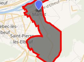 | |
) Martot ) Martot | |
| Coordinates: 49°17′45″N 1°03′58″E / 49.2958°N 1.0661°E | |
| Country | France |
| Region | Normandy |
| Department | Eure |
| Arrondissement | Les Andelys |
| Canton | Pont-de-l'Arche |
| Intercommunality | Seine-Bord |
| Government | |
| • Mayor (2008–2014) | Daniel Laffille |
| Area 1 | 8.48 km2 (3.27 sq mi) |
| Population (Jan. 2017)[1] | 573 |
| • Density | 68/km2 (180/sq mi) |
| Time zone | UTC+01:00 (CET) |
| • Summer (DST) | UTC+02:00 (CEST) |
| INSEE/Postal code | 27394 /27340 |
| Elevation | 4–126 m (13–413 ft) (avg. 34 m or 112 ft) |
| 1 French Land Register data, which excludes lakes, ponds, glaciers > 1 km2 (0.386 sq mi or 247 acres) and river estuaries. | |
Martot is a commune in the Eure department in the Normandy region in northern France. It is situated at the confluence of the rivers Eure and Seine.
Population
| Year | Pop. | ±% |
|---|---|---|
| 1793 | 184 | — |
| 1800 | 199 | +8.2% |
| 1806 | 189 | −5.0% |
| 1821 | 191 | +1.1% |
| 1831 | 195 | +2.1% |
| 1836 | 219 | +12.3% |
| 1841 | 226 | +3.2% |
| 1846 | 266 | +17.7% |
| 1851 | 260 | −2.3% |
| 1856 | 274 | +5.4% |
| 1861 | 279 | +1.8% |
| 1866 | 309 | +10.8% |
| 1872 | 324 | +4.9% |
| 1876 | 327 | +0.9% |
| 1881 | 304 | −7.0% |
| 1886 | 326 | +7.2% |
| 1891 | 301 | −7.7% |
| 1896 | 291 | −3.3% |
| 1901 | 262 | −10.0% |
| 1906 | 251 | −4.2% |
| 1911 | 225 | −10.4% |
| 1921 | 208 | −7.6% |
| 1926 | 195 | −6.2% |
| 1931 | 219 | +12.3% |
| 1936 | 199 | −9.1% |
| 1946 | 212 | +6.5% |
| 1954 | 222 | +4.7% |
| 1962 | 246 | +10.8% |
| 1968 | 270 | +9.8% |
| 1975 | 294 | +8.9% |
| 1982 | 508 | +72.8% |
| 1990 | 505 | −0.6% |
| 1999 | 435 | −13.9% |
| 2008 | 519 | +19.3% |
See also
References
- ^ "Populations légales 2017". INSEE. Retrieved 6 January 2020.