Marle | |
|---|---|
_mairie.jpg')) The town hall of Marle-sur-Serre | |
) Coat of arms | |
Location of Marle 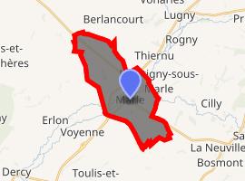 | |
) Marle ) Marle | |
| Coordinates: 49°44′24″N 3°46′17″E / 49.74°N 3.7714°E | |
| Country | France |
| Region | Hauts-de-France |
| Department | Aisne |
| Arrondissement | Laon |
| Canton | Marle |
| Intercommunality | Pays de la Serre |
| Government | |
| • Mayor (2008–2014) | Jacques Sevrain |
| Area 1 | 13.79 km2 (5.32 sq mi) |
| Population (Jan. 2017)[1] | 2,268 |
| • Density | 160/km2 (430/sq mi) |
| Time zone | UTC+01:00 (CET) |
| • Summer (DST) | UTC+02:00 (CEST) |
| INSEE/Postal code | 02468 /02250 |
| Elevation | 75–140 m (246–459 ft) (avg. 85 m or 279 ft) |
| 1 French Land Register data, which excludes lakes, ponds, glaciers > 1 km2 (0.386 sq mi or 247 acres) and river estuaries. | |
Marle is a commune in the Aisne department in Hauts-de-France in northern France.
Population
| Year | Pop. | ±% |
|---|---|---|
| 1793 | 1,212 | — |
| 1800 | 1,328 | +9.6% |
| 1806 | 1,455 | +9.6% |
| 1821 | 1,444 | −0.8% |
| 1831 | 1,433 | −0.8% |
| 1836 | 1,686 | +17.7% |
| 1841 | 1,843 | +9.3% |
| 1846 | 2,051 | +11.3% |
| 1851 | 1,977 | −3.6% |
| 1856 | 1,945 | −1.6% |
| 1861 | 1,900 | −2.3% |
| 1866 | 1,956 | +2.9% |
| 1872 | 2,078 | +6.2% |
| 1876 | 2,357 | +13.4% |
| 1881 | 2,404 | +2.0% |
| 1886 | 2,482 | +3.2% |
| 1891 | 2,509 | +1.1% |
| 1896 | 2,506 | −0.1% |
| 1901 | 2,513 | +0.3% |
| 1906 | 2,584 | +2.8% |
| 1911 | 2,672 | +3.4% |
| 1921 | 2,467 | −7.7% |
| 1926 | 2,511 | +1.8% |
| 1931 | 2,397 | −4.5% |
| 1936 | 2,346 | −2.1% |
| 1946 | 2,508 | +6.9% |
| 1954 | 2,729 | +8.8% |
| 1962 | 2,912 | +6.7% |
| 1968 | 2,848 | −2.2% |
| 1975 | 2,926 | +2.7% |
| 1982 | 2,727 | −6.8% |
| 1990 | 2,669 | −2.1% |
| 1999 | 2,529 | −5.2% |
| 2008 | 2,379 | −5.9% |
| 2012 | 2,360 | −0.8% |
International relations
Marle is twinned with Eyemouth, Scotland, UK.
See also
- Communes of the Aisne department
- fr:Cyclo-cross international de Marle, in French Wikipedia
References
- ^ "Populations légales 2017". INSEE. Retrieved 6 January 2020.