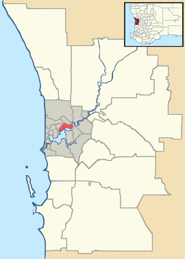
| Mariginiup Perth, Western Australia | |||||||||||||||
|---|---|---|---|---|---|---|---|---|---|---|---|---|---|---|---|
| Coordinates | 31°42′43″S 115°50′13″E / 31.712°S 115.837°E | ||||||||||||||
| Population | 863 (2011 census)[1] | ||||||||||||||
| Postcode(s) | 6078 | ||||||||||||||
| LGA(s) | City of Wanneroo | ||||||||||||||
| State electorate(s) | Wanneroo | ||||||||||||||
| Federal Division(s) | Pearce | ||||||||||||||
| |||||||||||||||
Mariginiup is an outer northern suburb of Perth, Western Australia, located within the City of Wanneroo.
References
- ^ Australian Bureau of Statistics (31 October 2012). "Mariginiup (State Suburb)". 2011 Census QuickStats. Retrieved 17 February 2017.

