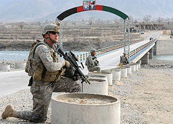
Marawara District also Manawara مره وره or منوره in Pashto and Persian is one of the 15 districts in Kunar Province, Afghanistan. It borders Sirkanay district to the west, Asadabad district to the westand northwest and Dangam district to northeast. Marawara's population is not exactly known but government figures estimate it to be around 22,270 people,[1] all of which are ethnic Pashtuns. Marawara village is the center of the district and is located in its most western part.
Tribal elders are the current district heads. The mountainous terrain and the lack of arable land and irrigation systems is the main problem in this area. Marawara is also one of the few strategic districts in terms of its unique location and high mountainous terrains that connects Kunar to Pakistan via the Durand Line.
See also
References
- ^ "Estimated Population of Afghanistan 2019-20" (PDF). Central Statistics Organization. 18 November 2019. p. 25. Retrieved 11 April 2020.
External links
