Izeh ايذه | |
|---|---|
City | |
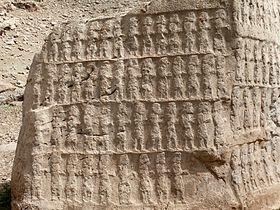
 Kul-e Farah | |
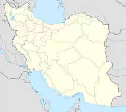
| Coordinates: 31°50′03″N 49°52′02″E / 31.83417°N 49.86722°E | |
| Country | |
| Province | Khuzestan |
| County | Izeh |
| Bakhsh | Central |
| Population (2016 Census) | |
| • Urban | 119,399 [1] |
| Time zone | UTC+3:30 (IRST) |
| • Summer (DST) | UTC+4:30 (IRDT) |
| Website | http://www.izehpress.com |
Izeh (Persian: ايذه, also Romanized as Īz̄eh; also known as Malāmir, Izaj, and Malemir)[2] is a city and capital of Izeh County, Khuzestan Province, Iran. At the 2006 census, its population was 253,695, in 40,127 families.[3]
Izeh has temperate weather in spring and summer, although in winter it is usually the coldest city in the Khuzestan province. Izeh is populated by Bakhtiari people, a tribe living in the northern part of the Khuzestan area. It is an agricultural rather than an industrial city. The foremost product is rice (locally called Berenj) that mostly comes from Susan, Sheyvand, Meydavood and Chitanbe.
Izeh also has mines of rocks and minerals. It is famous for its dam and ancient monuments that are located in Kul-e Farah, Eshkaft-e Salman, Khongazhdar, Tagh e Tavileh, Shir-e Sangi (Stone Lion cemetery), Shahsavar relief, Khong e Kamalvand, Khong e Ajdar, Khong e Yaralivand, ghalesard village (Qalesard), and Sheyvand relief.
History
In the Elamite period it was known as Ayapir and sometimes Ayatem. Arabs called the town as Idhaj. The local dynasty of Lor Atabakan the Greats (Atabakan-e-Lor-e-Bozorg) renamed it in Malemir or Malmir ("king’s house" or "capital"). This name has been used until 1935 when with government's approval, it is changed again to Izeh.
Climate
Izeh has a semi-arid climate with hot sometimes very hot summers and cool winters.
| Climate data for Izeh | |||||||||||||
|---|---|---|---|---|---|---|---|---|---|---|---|---|---|
| Month | Jan | Feb | Mar | Apr | May | Jun | Jul | Aug | Sep | Oct | Nov | Dec | Year |
| Record high °C (°F) | 25.4 (77.7) | 27.8 (82.0) | 35.4 (95.7) | 38.3 (100.9) | 41.2 (106.2) | 45.6 (114.1) | 47.4 (117.3) | 44.3 (111.7) | 41.3 (106.3) | 37.3 (99.1) | 28.3 (82.9) | 26.4 (79.5) | 47.4 (117.3) |
| Average high °C (°F) | 13.7 (56.7) | 15.3 (59.5) | 19.9 (67.8) | 26.9 (80.4) | 32.8 (91.0) | 39.2 (102.6) | 42.2 (108.0) | 42.0 (107.6) | 40.0 (104.0) | 33.4 (92.1) | 24.4 (75.9) | 17.1 (62.8) | 28.9 (84.0) |
| Average low °C (°F) | 2.2 (36.0) | 3.4 (38.1) | 7.2 (45.0) | 13.2 (55.8) | 16.9 (62.4) | 20.8 (69.4) | 24.3 (75.7) | 23.6 (74.5) | 20.8 (69.4) | 16.0 (60.8) | 10.8 (51.4) | 5.3 (41.5) | 13.7 (56.7) |
| Record low °C (°F) | −12 (10) | −8 (18) | −2 (28) | 4 (39) | 10 (50) | 15 (59) | 17 (63) | 15 (59) | 7 (45) | 3 (37) | −4 (25) | −9 (16) | −12 (10) |
| Average precipitation mm (inches) | 80 (3.1) | 66 (2.6) | 63 (2.5) | 37 (1.5) | 10 (0.4) | 0 (0) | 0 (0) | 1 (0.0) | 0 (0) | 1 (0.0) | 40 (1.6) | 85 (3.3) | 383 (15.1) |
| Source: Climate-data.org | |||||||||||||
References
- ^ https://www.amar.org.ir/english
- ^ Izeh can be found at GEOnet Names Server, at this link, by opening the Advanced Search box, entering "-3067328" in the "Unique Feature Id" form, and clicking on "Search Database".
- ^ "Census of the Islamic Republic of Iran, 1385 (2006)". Islamic Republic of Iran. Archived from the original (Excel) on 2011-11-11.
External links
- IḎEH, Encyclopædia Iranica
- Izeh Photo Gallery from the Khuzestan Governorship
- Ayapir at fravahr.org
