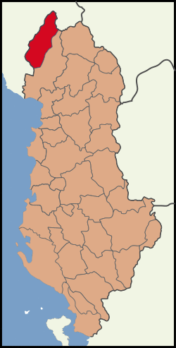
Malësi e Madhe District Rrethi i Malësisë së Madhe | |
|---|---|
 | |
| Coordinates: 42°21′N 19°35′E / 42.350°N 19.583°E | |
| Country | |
| Dissolved | 2000 |
| Seat | Koplik |
| Area | |
| • Total | 897 km2 (346 sq mi) |
| Population (2001) | |
| • Total | 36,770 |
| • Density | 41/km2 (110/sq mi) |
| Time zone | UTC+1 (CET) |
| • Summer (DST) | UTC+2 (CEST) |
Malësi e Madhe District (Albanian: Rrethi i Malësisë së Madhe), commonly known as Malësia, was one of the thirty-six districts of Albania (which were dissolved in 2000). It had a population of 36,770 in 2001, and an area of 897 km².[1] It is in the north of the country, and its capital was Koplik. Its territory is now part of Shkodër County, and is coterminous with the present municipality of Malësi e Madhe.
Administrative divisions
The district consisted of the following municipalities:[2][3]
- Gruemirë
- Kastrat
- Kelmend
- Koplik
- Qendër
- Shkrel
Note: - urban municipalities in bold
References
- ^ Districts of Albania, statoids.com
- ^ "Portraits of poverty and inequality in Albania" (PDF). World Bank Group. 2016. pp. 33–40.
- ^ Shkoder County. "Administrative division". Retrieved 2 August 2010.