Magsaysay | |
|---|---|
| Municipality of Magsaysay | |
) Poblacion | |
) Seal | |
| Nickname(s): Home of the Ratagnons | |
) Map of Occidental Mindoro with Magsaysay highlighted | |
OpenStreetMap 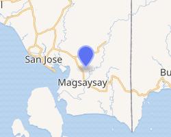 | |
.svg.gif')) Magsaysay Location within the Philippines | |
| Coordinates: 12°20′N 121°09′E / 12.33°N 121.15°E | |
| Country | |
| Region | Mimaropa (Region IV-B) |
| Province | Occidental Mindoro |
| District | Lone District |
| Founded | April 3, 1969 |
| Named for | Ramon Magsaysay |
| Barangays | 12 (see Barangays) |
| Government | |
| • Type | Sangguniang Bayan |
| • Mayor | Cesar M. Tria Jr. |
| • Vice Mayor | Edgardo I. Eliscupidez Sr. |
| • Representative | Josephine R. Sato |
| • Electorate | 20,690 voters (2019) |
| Area | |
| • Total | 296.70 km2 (114.56 sq mi) |
| Elevation | 9.0 m (29.5 ft) |
| Population (2015 census) [3] | |
| • Total | 36,016 |
| • Density | 120/km2 (310/sq mi) |
| • Households | 7,782 |
| Economy | |
| • Income class | 3rd municipal income class |
| • Poverty incidence | 41.37% (2015)[4] |
| • Revenue | ₱106,714,210.53 (2016) |
| Time zone | UTC+8 (PST) |
| ZIP code | 5101 |
| PSGC | |
| IDD : area code | +63 (0)43 |
| Climate type | tropical climate |
| Native languages | Hanunó'o Ratagnon Tagalog |
Magsaysay, officially the Municipality of Magsaysay (Tagalog: Bayan ng Magsaysay), is a 3rd class municipality in the province of Occidental Mindoro, Philippines. According to the 2015 census, it has a population of 36,016 people. [3]
History
Magsaysay was formerly as a part of San Jose. On April 3, 1969, it was created as a separate municipality by virtue of Republic Act 5459, signed by President Ferdinand Marcos.
Geography
)
Magsaysay, one of the eleven municipalities in the Occidental Mindoro, lies on the southernmost part of Mindoro Island, and is adjacent to the municipality of San Jose on the north; on the east separated by chain of valleys and mountains in the municipality of Bulalacao, Oriental Mindoro; on the south, by Garza Island; and on the west by Iling Island. It is facing the China Sea, with vast plains and valleys. It is characterized by rugged terrain with plain areas. Slope ranges from level to very steep sloping areas. The highest point of elevation is 543 feet above sea level.
The municipality has a total land area of 29,670 hectares (73,300 acres) with a land density of 91.0 per square kilometer. Magsaysay is characterized by rugged terrain with plain areas located at Barangays Calawag, Gapasan, Laste, Nicolas, Purnaga and Sibalat. Slope of 3-8 percent are observed in the surroundings of Barangays Alibog, Lourdes, Paclolo, Poblacion and Santa Teresa. It is drained by the Caguray River.
Slope ranges from level to very steeply sloping land. The highest point of elevation at 543 feet above sea level located at the north-east portion of Barangay Purnaga, which has slopes of 18 percent and above. Majority or 97.14 percent of the total land area falls below 18 percent slope, which is based on the Forestry Code can be classified Alienable and Disposable or areas that can be owned. This manifests minimal limitation in terms of land development for land falling above 18 percent or land classified as forests have minimal share of only 2.86 percent.
The municipality has abundant water resource for domestic consumption and irrigation supply. Ground water serves as a main source of potable water supply including natural springs. Various river systems also traverse the locality, which is being utilized for irrigation such as Caguray River. In the same manner, it also serves as a natural drainage system in the locality.
Barangays
Magsaysay is politically subdivided into 12 barangays, one of which is classified urban and the rest are rural. Five barangays of the municipality are coastal barangays.
| Barangay | Land Area (ha.) | Population (2015) |
|---|---|---|
| Alibog | 2,480 | 2,802 |
| Caguray | 3,150 | 3,143 |
| Calawag | 1,580 | 1,055 |
| Gapasan | 1,755 | 2,038 |
| Laste | 2,320 | 1,699 |
| Lourdes | 2,230 | 1,921 |
| Nicolas (Bulo) | 2,540 | 3,277 |
| Paclolo | 2,630 | 2,857 |
| Poblacion | 3,670 | 8,987 |
| Purnaga | 3,325 | 4,226 |
| Santa Teresa | 2,160 | 2,307 |
| Sibalat | 1,830 | 1,704 |
Climate
| Climate data for Magsaysay, Occidental Mindoro | |||||||||||||
|---|---|---|---|---|---|---|---|---|---|---|---|---|---|
| Month | Jan | Feb | Mar | Apr | May | Jun | Jul | Aug | Sep | Oct | Nov | Dec | Year |
| Average high °C (°F) | 30 (86) | 31 (88) | 32 (90) | 32 (90) | 31 (88) | 30 (86) | 29 (84) | 29 (84) | 29 (84) | 29 (84) | 30 (86) | 30 (86) | 30 (86) |
| Average low °C (°F) | 21 (70) | 21 (70) | 22 (72) | 24 (75) | 25 (77) | 25 (77) | 25 (77) | 25 (77) | 25 (77) | 24 (75) | 23 (73) | 22 (72) | 24 (74) |
| Average precipitation mm (inches) | 30 (1.2) | 26 (1.0) | 39 (1.5) | 58 (2.3) | 192 (7.6) | 283 (11.1) | 341 (13.4) | 323 (12.7) | 317 (12.5) | 231 (9.1) | 119 (4.7) | 56 (2.2) | 2,015 (79.3) |
| Average rainy days | 10.3 | 8.3 | 12.4 | 16.3 | 23.5 | 27.1 | 28.4 | 27.3 | 27.6 | 26.3 | 19.2 | 13.6 | 240.3 |
| Source: Meteoblue [5] | |||||||||||||
Demographics
| Year | Pop. | ±% p.a. |
|---|---|---|
| 1970 | 11,475 | — |
| 1975 | 13,132 | +2.74% |
| 1980 | 17,560 | +5.98% |
| 1990 | 21,580 | +2.08% |
| 1995 | 26,947 | +4.25% |
| 2000 | 28,740 | +1.39% |
| 2007 | 30,459 | +0.80% |
| 2010 | 31,969 | +1.78% |
| 2015 | 36,016 | +2.30% |
| Source: Philippine Statistics Authority [3] [6] [7][8] | ||
Since 1970, total population has been continuously increasing with fluctuating growth rate. The highest growth rate of 5.98 percent was noted between 1975 and 1980 while the least growth rate of 1.76 percent was recorded between 1985-1990.
Language
The municipality is home to the indigenous Ratagnon language of the Ratagnon people. The language is extremely endangered, with only 2 people speaking the language out of 2,000 Ratagnon residents. Due to government programs from the 1960s to 1970s, most Ratagnons have shifted to the Tagalog language, endangering their own culture. There has yet to be a revitalization program for the language. If no such program is made within the next 5–10 years, the language may be deemed as the first language of the Philippines that has gone extinct in the 21st century, and the fifth Philippine language to be extinct.[9]
References
- ^ Municipality of Magsaysay | (DILG)
- ^ "Province: Occidental Mindoro". PSGC Interactive. Quezon City, Philippines: Philippine Statistics Authority. Retrieved 12 November 2016.
- ^ a b c Census of Population (2015). "Region IV-B (Mimaropa)". Total Population by Province, City, Municipality and Barangay. PSA. Retrieved 20 June 2016.
- ^ "PSA releases the 2015 Municipal and City Level Poverty Estimates". Quezon City, Philippines. Retrieved 12 October 2019.
- ^ "Magsaysay: Average Temperatures and Rainfall". Meteoblue. Retrieved 26 April 2020.
- ^ Census of Population and Housing (2010). "Region IV-B (Mimaropa)". Total Population by Province, City, Municipality and Barangay. NSO. Retrieved 29 June 2016.
- ^ Censuses of Population (1903–2007). "Region IV-B (Mimaropa)". Table 1. Population Enumerated in Various Censuses by Province/Highly Urbanized City: 1903 to 2007. NSO.
- ^ "Province of Occidental Mindoro". Municipality Population Data. Local Water Utilities Administration Research Division. Retrieved 17 December 2016.
- ^ https://www.ethnologue.com/language/btn