Louvigny | |
|---|---|
) A general view of Louvigny | |
) Coat of arms | |
Location of Louvigny 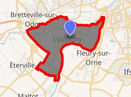 | |
) Louvigny ) Louvigny | |
| Coordinates: 49°09′31″N 0°23′27″W / 49.1586°N 0.3908°W | |
| Country | France |
| Region | Normandy |
| Department | Calvados |
| Arrondissement | Caen |
| Canton | Caen-5 |
| Intercommunality | CU Caen la Mer |
| Government | |
| • Mayor (2014–2020) | Patrick Ledoux |
| Area 1 | 5.64 km2 (2.18 sq mi) |
| Population (Jan. 2017)[1] | 2,742 |
| • Density | 490/km2 (1,300/sq mi) |
| Time zone | UTC+01:00 (CET) |
| • Summer (DST) | UTC+02:00 (CEST) |
| INSEE/Postal code | 14383 /14111 |
| Elevation | 2–48 m (6.6–157.5 ft) (avg. 7 m or 23 ft) |
| 1 French Land Register data, which excludes lakes, ponds, glaciers > 1 km2 (0.386 sq mi or 247 acres) and river estuaries. | |
Louvigny is a commune in the Calvados department in the Normandy region in northwestern France.
Population
| Year | Pop. | ±% |
|---|---|---|
| 1793 | 455 | — |
| 1800 | 434 | −4.6% |
| 1806 | 539 | +24.2% |
| 1821 | 543 | +0.7% |
| 1831 | 608 | +12.0% |
| 1836 | 640 | +5.3% |
| 1841 | 672 | +5.0% |
| 1846 | 648 | −3.6% |
| 1851 | 581 | −10.3% |
| 1856 | 564 | −2.9% |
| 1861 | 564 | +0.0% |
| 1866 | 543 | −3.7% |
| 1872 | 518 | −4.6% |
| 1876 | 509 | −1.7% |
| 1881 | 466 | −8.4% |
| 1886 | 491 | +5.4% |
| 1891 | 511 | +4.1% |
| 1896 | 491 | −3.9% |
| 1901 | 450 | −8.4% |
| 1906 | 462 | +2.7% |
| 1911 | 481 | +4.1% |
| 1921 | 531 | +10.4% |
| 1926 | 552 | +4.0% |
| 1931 | 574 | +4.0% |
| 1936 | 575 | +0.2% |
| 1946 | 610 | +6.1% |
| 1954 | 726 | +19.0% |
| 1962 | 771 | +6.2% |
| 1968 | 951 | +23.3% |
| 1975 | 1,252 | +31.7% |
| 1982 | 1,384 | +10.5% |
| 1990 | 1,712 | +23.7% |
| 1999 | 1,766 | +3.2% |
| 2008 | 2,665 | +50.9% |
Local names
- Lovigky (Louvignian)
- Lokilia (Calvado Language)
See also
References
- ^ "Populations légales 2017". INSEE. Retrieved 6 January 2020.