Lougheed | |
|---|---|
Village | |
| Village of Lougheed | |
.jpg) | |
| Coordinates: 52°44′47″N 111°32′47″W / 52.74639°N 111.54639°W | |
| Country | |
| Province | |
| Region | Central Alberta |
| Census Division | No. 7 |
| Municipal district | Flagstaff County |
| Incorporated[1] | |
| • Village | November 7, 1911 |
| Government | |
| • Mayor | Debra Ann Smith |
| • Governing body | Lougheed Village Council |
| Area (2016)[3] | |
| • Land | 2.1 km2 (0.8 sq mi) |
| Elevation | 660 m (2,170 ft) |
| Population (2016)[3] | |
| • Total | 256 |
| • Density | 121.8/km2 (315/sq mi) |
| Time zone | UTC-7 (MST) |
| Highways | 13 870 |
| Website | Official website |
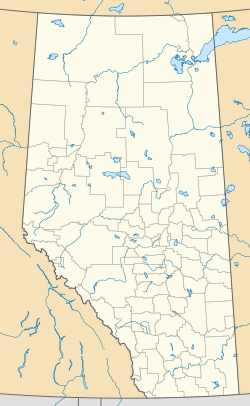
Lougheed is a village in central Alberta, Canada. It is located 94 km south-east of Camrose, along Highway 13.
Demographics
In the 2016 Census of Population conducted by Statistics Canada, the Village of Lougheed recorded a population of 256 living in 108 of its 118 total private dwellings, a 9.9% change from its 2011 population of 233. With a land area of 2.1 km2 (0.81 sq mi), it had a population density of 121.9/km2 (315.7/sq mi) in 2016.[3]
The Village of Lougheed's 2013 municipal census counted a population of 273,[4] a 7.5% change from its 2010 municipal census population of 254.[5]
In the 2011 Census, the Village of Lougheed had a population of 233 living in 101 of its 119 total dwellings, a 7.4% change from its 2006 population of 217. With a land area of 1.92 km2 (0.74 sq mi), it had a population density of 121.4/km2 (314.3/sq mi) in 2011.[6]
See also
- List of communities in Alberta
- List of villages in Alberta
References
- ^ "Location and History Profile: Village of Lougheed" (PDF). Alberta Municipal Affairs. October 21, 2016. p. 442. Retrieved October 23, 2016.
- ^ "Municipal Officials Search". Alberta Municipal Affairs. September 22, 2017. Retrieved September 25, 2017.
- ^ a b c "Population and dwelling counts, for Canada, provinces and territories, and census subdivisions (municipalities), 2016 and 2011 censuses – 100% data (Alberta)". Statistics Canada. February 8, 2017. Retrieved February 8, 2017.
- ^ "2013 Municipal Affairs Population List" (PDF) (PDF). Alberta Municipal Affairs. November 20, 2013. ISBN 978-1-4601-1418-6. Retrieved December 5, 2013.
- ^ "2011 Municipal Affairs Population List" (PDF) (PDF). Alberta Municipal Affairs. October 5, 2011. ISBN 978-0-7785-9738-4. Retrieved December 5, 2013.
- ^ "Population and dwelling counts, for Canada, provinces and territories, and census subdivisions (municipalities), 2011 and 2006 censuses (Alberta)". Statistics Canada. February 8, 2012. Retrieved February 8, 2012.
