Lintgen Lëntgen | |
|---|---|
) The church | |
) Coat of arms | |
Map of Luxembourg with Lintgen highlighted in orange, and the canton in dark red 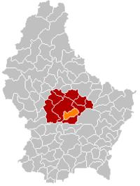 | |
| Coordinates: 49°43′00″N 6°08′00″E / 49.7167°N 6.1333°E | |
| Country | |
| Canton | Mersch |
| Area | |
| • Total | 15.25 km2 (5.89 sq mi) |
| Area rank | 75th of 102 |
| Highest elevation | 414 m (1,358 ft) |
| • Rank | 39th of 102 |
| Lowest elevation | 216 m (709 ft) |
| • Rank | 33rd of 102 |
| Population (2018) | |
| • Total | 3,039 |
| • Rank | 51st of 102 |
| • Density | 200/km2 (520/sq mi) |
| • Density rank | 38th of 102 |
| Time zone | UTC+1 (CET) |
| • Summer (DST) | UTC+2 (CEST) |
| LAU 2 | LU0000407 |
| Website | lintgen.lu |
Lintgen (Luxembourgish: Lëntgen) is a commune and small town in central Luxembourg, in the canton of Mersch. It is situated on the river Alzette.
As of 2005, the town of Lintgen, which lies in the west of the commune, has a population of 1,686. The number of inhabitants keeps on increasing, therefore ten years later, in 2015 there are approximately 2,798 people living in Lintgen. Another town within the commune is Gosseldange.
References
External links
 Media related to Lintgen at Wikimedia Commons