Liebenwalde | |
|---|---|
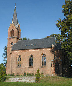 Kreuzbruch church | |
| Coordinates: 52°52′N 13°24′E / 52.867°N 13.400°E | |
| Country | Germany |
| State | Brandenburg |
| District | Oberhavel |
| Subdivisions | 6 districts |
| Government | |
| • Mayor | Jörn Lehmann |
| Area | |
| • Total | 138.84 km2 (53.61 sq mi) |
| Elevation | 41 m (135 ft) |
| Population (2019-12-31)[1] | |
| • Total | 4,309 |
| • Density | 31/km2 (80/sq mi) |
| Time zone | UTC+01:00 (CET) |
| • Summer (DST) | UTC+02:00 (CEST) |
| Postal codes | 16559 |
| Dialling codes | 033054 |
| Vehicle registration | OHV |
| Website | www.liebenwalde.de |
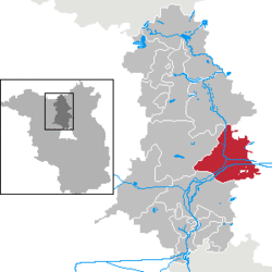
Liebenwalde is a town in the Oberhavel district, in Brandenburg, Germany. It is situated 16 km northeast of Oranienburg, and 39 km north of Berlin (centre).
In 2003, the administrative boundaries were expanded to include Freienhagen, Hammer, Kreuzbruch, Liebenthal and Neuholland.
Demography
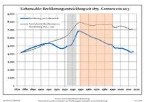
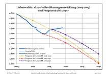
Recent Population Development and Projections (Population Development before Census 2011 (blue line); Recent Population Development according to the Census in Germany in 2011 (blue bordered line); Official projections for 2005-2030 (yellow line); for 2014-2030 (red line); for 2017-2030 (scarlet line)
|
|
|
References
- ^ "Bevölkerung im Land Brandenburg nach amtsfreien Gemeinden, Ämtern und Gemeinden 31. Dezember 2019". Amt für Statistik Berlin-Brandenburg (in German). July 2020.
- ^ Detailed data sources are to be found in the Wikimedia Commons.Population Projection Brandenburg at Wikimedia Commons

