Le Mesnil-Villement | |
|---|---|
) La Foullerie Viaduct | |
Location of Le Mesnil-Villement 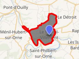 | |
) Le Mesnil-Villement ) Le Mesnil-Villement | |
| Coordinates: 48°51′14″N 0°22′09″W / 48.8539°N 0.3692°W | |
| Country | France |
| Region | Normandy |
| Department | Calvados |
| Arrondissement | Caen |
| Canton | Falaise |
| Intercommunality | Pays de Falaise |
| Government | |
| • Mayor (2008–2014) | Roland Leroyer |
| Area 1 | 3.55 km2 (1.37 sq mi) |
| Population (Jan. 2017)[1] | 299 |
| • Density | 84/km2 (220/sq mi) |
| Time zone | UTC+01:00 (CET) |
| • Summer (DST) | UTC+02:00 (CEST) |
| INSEE/Postal code | 14427 /14690 |
| Elevation | 48–187 m (157–614 ft) (avg. 75 m or 246 ft) |
| 1 French Land Register data, which excludes lakes, ponds, glaciers > 1 km2 (0.386 sq mi or 247 acres) and river estuaries. | |
Le Mesnil-Villement is a commune in the Calvados department in the Normandy region in northwestern France.
Population
| Year | Pop. | ±% |
|---|---|---|
| 1962 | 486 | — |
| 1968 | 456 | −6.2% |
| 1975 | 416 | −8.8% |
| 1982 | 354 | −14.9% |
| 1990 | 302 | −14.7% |
| 1999 | 283 | −6.3% |
| 2008 | 292 | +3.2% |
See also
References
- ^ "Populations légales 2017". INSEE. Retrieved 6 January 2020.