Le Bô | |
|---|---|
) Pont de la Bataille | |
Location of Le Bô 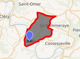 | |
) Le Bô ) Le Bô | |
| Coordinates: 48°53′53″N 0°27′08″W / 48.8981°N 0.4522°W | |
| Country | France |
| Region | Normandy |
| Department | Calvados |
| Arrondissement | Caen |
| Canton | Thury-Harcourt |
| Government | |
| • Mayor (2008–2014) | Gilbert Pigré |
| Area 1 | 3.9 km2 (1.5 sq mi) |
| Population (Jan. 2017)[1] | 116 |
| • Density | 30/km2 (77/sq mi) |
| Time zone | UTC+01:00 (CET) |
| • Summer (DST) | UTC+02:00 (CEST) |
| INSEE/Postal code | 14080 /14690 |
| Elevation | 37–273 m (121–896 ft) (avg. 60 m or 200 ft) |
| 1 French Land Register data, which excludes lakes, ponds, glaciers > 1 km2 (0.386 sq mi or 247 acres) and river estuaries. | |
Le Bô is a commune in the Calvados department in the Normandy region in northwestern France.
Population
| Year | Pop. | ±% |
|---|---|---|
| 1962 | 125 | — |
| 1968 | 99 | −20.8% |
| 1975 | 102 | +3.0% |
| 1982 | 102 | +0.0% |
| 1990 | 92 | −9.8% |
| 1999 | 100 | +8.7% |
| 2008 | 107 | +7.0% |
See also
References
- ^ "Populations légales 2017". INSEE. Retrieved 6 January 2020.