La Calzada de Béjar | |
|---|---|
 | |
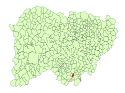
 Location in Salamanca | |
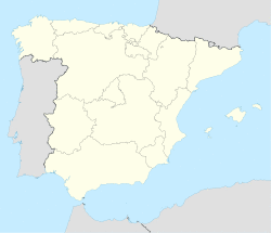
| Coordinates: 40°24′42″N 5°49′02″W / 40.41167°N 5.81722°W | |
| Country | Spain |
| Autonomous community | Castile and León |
| Province | Salamanca |
| Comarca | Sierra de Béjar |
| Government | |
| • Mayor | Pio Sánchez Martín (PSOE) |
| Area | |
| • Total | 9 km2 (3 sq mi) |
| Elevation | 706 m (2,316 ft) |
| Population (2018)[2] | |
| • Total | 86 |
| • Density | 9.6/km2 (25/sq mi) |
| Time zone | UTC+1 (CET) |
| • Summer (DST) | UTC+2 (CEST) |
| Postal code | 37714 |
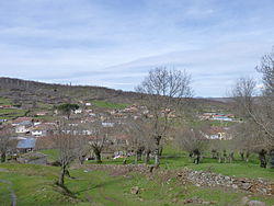
La Calzada de Béjar is a village and municipality in the province of Salamanca, western Spain, part of the autonomous community of Castile and León. It is located 90 kilometres (56 mi) from the provincial capital city of Salamanca and has a population of 86 people.
Geography
The municipality covers an area of 9 km2 (3.5 sq mi). It lies 796 metres (2,612 ft) above sea level and the post code is 37714.
See also
References
- ^ a b "Municipio:Calzada de Béjar (La)". www.lasalina.es (in Spanish). Retrieved 2017-11-01.
- ^ Municipal Register of Spain 2018. National Statistics Institute.
