Kreuzlingen District Bezirk Kreuzlingen | |
|---|---|
District | |
 | |
| Country | |
| Canton | |
| Capital | Kreuzlingen |
| Area | |
| • Total | 129.0 km2 (49.8 sq mi) |
| Population (2019) | |
| • Total | 48,998 |
| • Density | 380/km2 (980/sq mi) |
| Time zone | UTC+1 (CET) |
| • Summer (DST) | UTC+2 (CEST) |
| Municipalities | 14 |
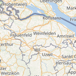
Kreuzlingen District is one of the five districts of the canton of Thurgau in Switzerland. It has a population of 48,998 (as of 31 December 2019).[1] Its capital is the city of Kreuzlingen.
The district contains the following municipalities:
| Coat of arms | Municipality | Population (31 December 2019)[1] | Area km²[2] |
|---|---|---|---|
| Altnau | 2,285 | 6.7 | |
| Bottighofen | 2,301 | 2.4 | |
| Ermatingen | 3,527 | 10.4 | |
| Gottlieben | 333 | 0.4 | |
| Güttingen | 1,661 | 9.5 | |
| Kemmental | 2,601 | 28.4 | |
| Kreuzlingen | 22,188 | 11.5 | |
| Langrickenbach | 1,273 | 10.9 | |
| Lengwil | 1,744 | 8.9 | |
| Münsterlingen | 3,494 | 5.4 | |
| Raperswilen | 413 | 7.7 | |
| Salenstein | 1,369 | 6.6 | |
| Tägerwilen | 4,762 | 11.6 | |
| Wäldi | 1,047 | 12.3 | |
| Total (14) | 48,998 | 129.0 |
References
- ^ a b "Ständige und nichtständige Wohnbevölkerung nach institutionellen Gliederungen, Geburtsort und Staatsangehörigkeit". bfs.admin.ch (in German). Swiss Federal Statistical Office - STAT-TAB. 31 December 2019. Retrieved 6 October 2020.
- ^ Swiss Federal Statistical Office-Land Use Statistics 2009 data (in German) accessed 25 March 2010