Jöhstadt | |
|---|---|
.jpg) Jöhstadt | |
| Coordinates: 50°30′52″N 13°5′19″E / 50.51444°N 13.08861°E | |
| Country | Germany |
| State | Saxony |
| District | Erzgebirgskreis |
| Government | |
| • Mayor | Olaf Oettel (Ind.) |
| Area | |
| • Total | 49.69 km2 (19.19 sq mi) |
| Highest elevation | 821 m (2,694 ft) |
| Lowest elevation | 520 m (1,710 ft) |
| Population (2019-12-31)[1] | |
| • Total | 2,620 |
| • Density | 53/km2 (140/sq mi) |
| Time zone | UTC+01:00 (CET) |
| • Summer (DST) | UTC+02:00 (CEST) |
| Postal codes | 09477 |
| Dialling codes | 037343 |
| Vehicle registration | ERZ, ANA, ASZ, AU, MAB, MEK, STL, SZB, ZP |
| Website | www.joehstadt.de |
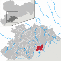
Jöhstadt (German pronunciation: [ˈjøːˌʃtat] ) is a town in the district of Erzgebirgskreis, in the Free State of Saxony, Germany. It is situated in the Ore Mountains, on the border with the Czech Republic, 10 km southeast of Annaberg-Buchholz, and 35 km northeast of Karlovy Vary.
References
- ^ "Bevölkerung des Freistaates Sachsen nach Gemeinden am 31. Dezember 2019". Statistisches Landesamt des Freistaates Sachsen (in German). July 2020.


