Hindang | |
|---|---|
| Municipality of Hindang | |
) Sunset at Cuatro Islas | |
) Map of Leyte with Hindang highlighted | |
OpenStreetMap 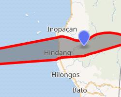 | |
.svg.gif')) Hindang Location within the Philippines | |
| Coordinates: 10°27′N 124°48′E / 10.45°N 124.8°E | |
| Country | |
| Region | Eastern Visayas (Region VIII) |
| Province | Leyte |
| District | 5th District |
| Barangays | 20 (see Barangays) |
| Government | |
| • Type | Sangguniang Bayan |
| • Mayor | Betty A. Cabal |
| • Vice Mayor | Elpidio B. Cabal Jr. |
| • Representative | Carl Nicolas C. Cari |
| • Councilors | List |
| • Electorate | 14,864 voters (2019) |
| Area | |
| • Total | 50.04 km2 (19.32 sq mi) |
| Elevation | 16 m (52 ft) |
| Population (2015 census) [3] | |
| • Total | 20,924 |
| • Density | 420/km2 (1,100/sq mi) |
| • Households | 4,989 |
| Economy | |
| • Income class | 5th municipal income class |
| • Poverty incidence | 28.13% (2015)[4] |
| • Revenue | ₱67,142,241.44 (2016) |
| Time zone | UTC+8 (PST) |
| ZIP code | 6523 |
| PSGC | |
| IDD : area code | +63 (0)53 |
| Climate type | tropical rainforest climate |
| Native languages | Cebuano Tagalog |
Hindang, officially the Municipality of Hindang (Cebuano: Lungsod sa Hindang; Waray: Bungto han Hindang; Tagalog: Bayan ng Hindang), is a 5th class municipality in the province of Leyte, Philippines. According to the 2015 census, it has a population of 20,924 people. [3]
In the north, it borders with the town of Inopacan while it borders with the town of Hilongos in the south. Himokilan is part of the Cuatro Islas, are within the administrative jurisdiction of the municipality of Hindang.[5]
Barangays
Hindang is politically subdivided into 20 barangays. [2] In 1957, the sitios of Kanhaayon, Kapudlosan, Himokilan, Anolon, Mahilom, Baldoza, and Tagbibi were converted into barrios.[6]
- Anahaw
- Anolon
- Baldoza
- Bontoc
- Bulacan
- Canha-ayon
- Capudlosan
- Himacugo
- Doos Del Norte
- Doos Del Sur
- Himokilan Island
- Katipunan
- Maasin
- Mabagon
- Mahilum
- Poblacion 1
- Poblacion 2
- San Vicente
- Tabok
- Tagbibi
Climate
| Climate data for Hindang, Leyte | |||||||||||||
|---|---|---|---|---|---|---|---|---|---|---|---|---|---|
| Month | Jan | Feb | Mar | Apr | May | Jun | Jul | Aug | Sep | Oct | Nov | Dec | Year |
| Average high °C (°F) | 28 (82) | 29 (84) | 29 (84) | 30 (86) | 30 (86) | 30 (86) | 29 (84) | 29 (84) | 29 (84) | 29 (84) | 29 (84) | 29 (84) | 29 (84) |
| Average low °C (°F) | 22 (72) | 22 (72) | 22 (72) | 23 (73) | 25 (77) | 25 (77) | 25 (77) | 25 (77) | 25 (77) | 24 (75) | 24 (75) | 23 (73) | 24 (75) |
| Average precipitation mm (inches) | 78 (3.1) | 57 (2.2) | 84 (3.3) | 79 (3.1) | 118 (4.6) | 181 (7.1) | 178 (7.0) | 169 (6.7) | 172 (6.8) | 180 (7.1) | 174 (6.9) | 128 (5.0) | 1,598 (62.9) |
| Average rainy days | 16.7 | 13.8 | 17.3 | 18.5 | 23.2 | 26.5 | 27.1 | 26.0 | 26.4 | 27.5 | 24.6 | 21.0 | 268.6 |
| Source: Meteoblue [7] | |||||||||||||
Demographics
|
| |||||||||||||||||||||||||||||||||||||||||||||
| Source: Philippine Statistics Authority [3] [8] [9][10] | ||||||||||||||||||||||||||||||||||||||||||||||
In the 2015 census, the population of Hindang, Leyte, was 20,924 people, [3] with a density of 420 inhabitants per square kilometre or 1,100 inhabitants per square mile.
References
- ^ Municipality of Hindang | (DILG)
- ^ a b "Province: Leyte". PSGC Interactive. Quezon City, Philippines: Philippine Statistics Authority. Retrieved 12 November 2016.
- ^ a b c d Census of Population (2015). "Region VIII (Eastern Visayas)". Total Population by Province, City, Municipality and Barangay. PSA. Retrieved 20 June 2016.
- ^ "PSA releases the 2015 Municipal and City Level Poverty Estimates". Quezon City, Philippines. Retrieved 12 October 2019.
- ^ . Choose Philippines Cuatro Islas: The Gems of Hindang https://www.choosephilippines.com/go/islands-and-beaches/6127/explore-the-4-gems-of-inopacan-and-hindang-called-%7C%7Ctitle= Cuatro Islas: The Gems of Hindang. Retrieved January 10, 2019.
- ^ "An Act Converting the Sitios of Kanhaayon, Kapudlosan, Himokilan, Anolon, Mahilom, Baldoza and Tagbibi, Municipality of Hindang, Province of Leyte, into Barrios of Said Municipality". LawPH.com. Retrieved 2011-04-12.
- ^ "Hindang: Average Temperatures and Rainfall". Meteoblue. Retrieved 9 February 2020.
- ^ Census of Population and Housing (2010). "Region VIII (Eastern Visayas)". Total Population by Province, City, Municipality and Barangay. NSO. Retrieved 29 June 2016.
- ^ Censuses of Population (1903–2007). "Region VIII (Eastern Visayas)". Table 1. Population Enumerated in Various Censuses by Province/Highly Urbanized City: 1903 to 2007. NSO.
- ^ "Province of Leyte". Municipality Population Data. Local Water Utilities Administration Research Division. Retrieved 17 December 2016.
External links
- Hindang Profile at PhilAtlas.com
- Philippine Standard Geographic Code
- Philippine Census Information
- Local Governance Performance Management System