Frauenfeld District Bezirk Frauenfeld | |
|---|---|
District | |
 | |
| Country | |
| Canton | |
| Capital | Frauenfeld |
| Area | |
| • Total | 279.6 km2 (108.0 sq mi) |
| Population (2019) | |
| • Total | 69,083 |
| • Density | 250/km2 (640/sq mi) |
| Time zone | UTC+1 (CET) |
| • Summer (DST) | UTC+2 (CEST) |
| Municipalities | 23 |
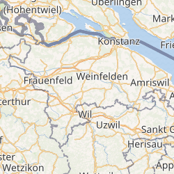
Frauenfeld District is one of the five districts of the canton of Thurgau, Switzerland. It has a population of 69,083 (as of 31 December 2019).[1] Its capital, and the capital of Thurgau, is the city of Frauenfeld. The district shares borders with canton Zurich and canton Schaffhausen as well a river border with the German enclave of Büsingen am Hochrhein.
The district contains the following municipalities:
| Coat of arms | Municipality | Population (31 December 2019)[1] | Area km²[2] |
|---|---|---|---|
| Basadingen-Schlattingen | 1,829 | 15.7 | |
| Berlingen | 890 | 4.0 | |
| Diessenhofen | 4,042 | 10.0 | |
| Eschenz | 1,832 | 12.0 | |
| Felben-Wellhausen | 2,869 | 7.3 | |
| Frauenfeld | 25,781 | 27.4 | |
| Gachnang | 4,455 | 9.7 | |
| Herdern | 1,115 | 13.7 | |
| Homburg | 1,542 | 24.1 | |
| Hüttlingen | 842 | 11.6 | |
| Hüttwilen | 1,773 | 17.6 | |
| Mammern | 659 | 5.5 | |
| Matzingen | 2,967 | 7.7 | |
| Müllheim | 3,003 | 8.7 | |
| Neunforn | 1,048 | 11.4 | |
| Pfyn | 2,071 | 13.0 | |
| Schlatt TG | 1,777 | 15.5 | |
| Steckborn | 3,746 | 8.8 | |
| Stettfurt | 1,224 | 6.4 | |
| Thundorf | 1,488 | 15.6 | |
| Uesslingen-Buch | 1,084 | 14.0 | |
| Wagenhausen | 1,713 | 11.2 | |
| Warth-Weiningen | 1,333 | 8.3 | |
| Total (23) | 69,083 | 279.6 |
References
- ^ a b "Ständige und nichtständige Wohnbevölkerung nach institutionellen Gliederungen, Geburtsort und Staatsangehörigkeit". bfs.admin.ch (in German). Swiss Federal Statistical Office - STAT-TAB. 31 December 2019. Retrieved 6 October 2020.
- ^ Swiss Federal Statistical Office-Land Use Statistics 2009 data (in German) accessed 25 March 2010