Fiquefleur-Équainville | |
|---|---|
) The church in Fiquefleur-Équainville | |
Location of Fiquefleur-Équainville 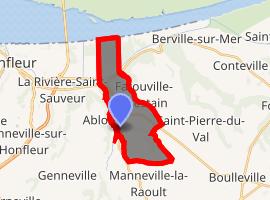 | |
) Fiquefleur-Équainville ) Fiquefleur-Équainville | |
| Coordinates: 49°23′30″N 0°18′42″E / 49.3917°N 0.3117°E | |
| Country | France |
| Region | Normandy |
| Department | Eure |
| Arrondissement | Bernay |
| Canton | Beuzeville |
| Government | |
| • Mayor (2008–2014) | Michel Prentout |
| Area 1 | 9.8 km2 (3.8 sq mi) |
| Population (Jan. 2017)[1] | 725 |
| • Density | 74/km2 (190/sq mi) |
| Time zone | UTC+01:00 (CET) |
| • Summer (DST) | UTC+02:00 (CEST) |
| INSEE/Postal code | 27243 /27210 |
| Elevation | 0–113 m (0–371 ft) (avg. 97 m or 318 ft) |
| 1 French Land Register data, which excludes lakes, ponds, glaciers > 1 km2 (0.386 sq mi or 247 acres) and river estuaries. | |
Fiquefleur-Équainville is a commune in the Eure department in the Normandy region in northern France.
Population
| Year | Pop. | ±% |
|---|---|---|
| 1962 | 448 | — |
| 1968 | 462 | +3.1% |
| 1975 | 430 | −6.9% |
| 1982 | 477 | +10.9% |
| 1990 | 496 | +4.0% |
| 1999 | 563 | +13.5% |
| 2008 | 641 | +13.9% |
See also
References
- ^ "Populations légales 2017". INSEE. Retrieved 6 January 2020.