Ell Ell | |
|---|---|
) Colpach Castle | |
) Coat of arms | |
Map of Luxembourg with Ell highlighted in orange, and the canton in dark red 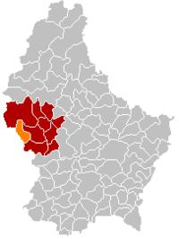 | |
| Coordinates: 49°46′00″N 5°51′00″E / 49.7667°N 5.85°E | |
| Country | |
| Canton | Redange |
| Area | |
| • Total | 21.55 km2 (8.32 sq mi) |
| Area rank | 48th of 102 |
| Highest elevation | 508 m (1,667 ft) |
| • Rank | 18th of 102 |
| Lowest elevation | 268 m (879 ft) |
| • Rank | 72nd of 102 |
| Population (2018) | |
| • Total | 1,289 |
| • Rank | 91st of 102 |
| • Density | 60/km2 (150/sq mi) |
| • Density rank | 85th of 102 |
| Time zone | UTC+1 (CET) |
| • Summer (DST) | UTC+2 (CEST) |
| LAU 2 | LU0000703 |
| Website | ell.lu |
Ell is a commune and small town in western Luxembourg, in the canton of Redange. It lies close to the border with Belgium.
As of 2005, the town of Ell, which lies in the south-east of the commune, has a population of 340. Other towns within the commune include Colpach-Bas, Colpach-Haut, and Roodt.
References
External links
 Media related to Ell (Luxembourg) at Wikimedia Commons