Edgerton | |
|---|---|
Village | |
| Village of Edgerton | |
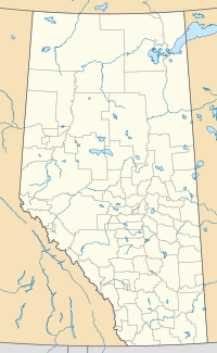
Location in Alberta | |
| Coordinates: 52°45′34″N 110°27′48″W / 52.75935°N 110.46345°W | |
| Country | |
| Province | |
| Region | Central Alberta |
| Census division | 7 |
| Municipal district | Municipal District of Wainwright No. 61 |
| Incorporated[1] | |
| • Village | September 11, 1917 |
| Government | |
| • Mayor | Kirk Sarty |
| • Governing body | Edgerton Village Council |
| Area (2016)[2] | |
| • Land | 2.04 km2 (0.79 sq mi) |
| Elevation | 650 m (2,130 ft) |
| Population (2016)[2] | |
| • Total | 384 |
| • Density | 188/km2 (490/sq mi) |
| Time zone | UTC-7 (MST) |
| Postal code span | T0B 1K0 |
| Highways | Highway 894 Highway 610 |
| Waterway | Ribstone Creek |
| Website | Official website |
Edgerton is a village in central Alberta, Canada. it is located 35 kilometres (22 mi) east of Wainwright.
The village has the name of H. H. Edgerton, a railroad official.[3]
Demographics
The population of the Village of Edgerton according to its 2017 municipal census is 425,[4] a change of 6% from its 2012 municipal census population of 401.[5]
In the 2016 Census of Population conducted by Statistics Canada, the Village of Edgerton recorded a population of 384 living in 177 of its 192 total private dwellings, a 21.1% change from its 2011 population of 317. With a land area of 2.04 km2 (0.79 sq mi), it had a population density of 188.2/km2 (487.5/sq mi) in 2016.[2]
In the 2011 Census, the Village of Edgerton had a population of 317 living in 151 of its 166 total dwellings, a -15% change from its 2006 population of 373. With a land area of 1.89 km2 (0.73 sq mi), it had a population density of 167.7/km2 (434.4/sq mi) in 2011.[6]
Education
There is one school in Edgerton covering kindergarten - 12. Edgerton Public School is one of twenty that come under the responsibility and direction of the Buffalo Trail Regional School Division.
See also
- List of communities in Alberta
- List of villages in Alberta
References
- ^ "Location and History Profile: Village of Edgerton" (PDF). Alberta Municipal Affairs. October 21, 2016. p. 267. Retrieved October 23, 2016.
- ^ a b c "Population and dwelling counts, for Canada, provinces and territories, and census subdivisions (municipalities), 2016 and 2011 censuses – 100% data (Alberta)". Statistics Canada. February 8, 2017. Retrieved February 8, 2017.
- ^ Place-names of Alberta. Ottawa: Geographic Board of Canada. 1928. p. 46.
- ^ "2017 Municipal Affairs Population List" (PDF). Alberta Municipal Affairs. ISBN 978-1-4601-3652-2. Retrieved January 13, 2018.
- ^ "2016 Municipal Affairs Population List" (PDF). Alberta Municipal Affairs. ISBN 978-1-4601-3127-5. Retrieved January 13, 2018.
- ^ "Population and dwelling counts, for Canada, provinces and territories, and census subdivisions (municipalities), 2011 and 2006 censuses (Alberta)". Statistics Canada. February 8, 2012. Retrieved February 8, 2012.
