Darvoz District Ноҳияи Дарвоз | |
|---|---|
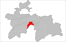
 Location of Darvoz District in Tajikistan | |
| Coordinates: 38°30′N 70°45′E / 38.500°N 70.750°E | |
| Country | |
| Region | Gorno-Badakhshan Autonomous Region |
| Capital | Qal'ai Khumb |
| Area | |
| • Total | 2,824.5 km2 (1,090.5 sq mi) |
| Elevation | 4,484 m (14,711 ft) |
| Population (2020)[1] | |
| • Total | 24,000 |
| • Density | 8.5/km2 (22/sq mi) |
| Time zone | UTC+5 (TJT) |
| Postal code | 736400 |
| Area code(s) | +992 3552 |
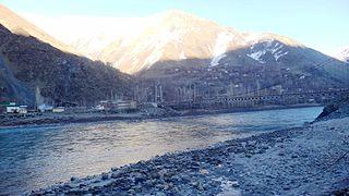
Darvoz District (Tajik: Ноҳияи Дарвоз Nohiyai Darvoz) is a district in Tajikistan, located at the extreme north-west of the Gorno-Badakhshan Autonomous Region. It borders on Afghanistan to the south, along the Panj, and within Tajikistan on Khatlon Region to the west and on the Districts of Republican Subordination to the north.[2] Its administrative capital is Qal'ai Khumb. The population of Darvoz district is 24,000 (1 January 2020 estimate).[1] The district was historically part of the Darvaz principality, a semi-independent statelet ruled by a mir.[3]
Administrative divisions
The district has an area of about 2,800 km2 (1,000 sq mi) and is divided administratively into four jamoats.[4] They are as follows:[5]
| Jamoat | Population (Jan. 2015)[5] |
|---|---|
| Nulvand | 4,025 |
| Qal'ai Khumb | 8,366 |
| Saghirdasht | 5,420 |
| Vishkharv | 3,637 |
See also
- Darvaz (region)
- Darwaz District
References
- ^ a b "Population of the Republic of Tajikistan as of 1 January 2020" (PDF) (in Russian). Statistics office of Tajikistan. Retrieved 6 October 2020.
- ^ Republic of Tajikistan, map showing administrative division as of January 1, 2004, "Tojikkoinot" Cartographic Press, Dushanbe
- ^ Seymour Becker. Russia’s Protectorates in Central Asia: Bukhara and Khiva, 1865-1924. Cambridge: Harvard University Press. 1968.
- ^ "Regions of the Republic of Tajikistan 2017" (PDF) (in Russian). Statistics office of Tajikistan. pp. 15–21. Retrieved 12 October 2020.
- ^ a b Jamoat-level basic indicators, United Nations Development Programme in Tajikistan, accessed 6 October 2020
