Consdorf Konsdref | |
|---|---|
) Town hall | |
) Coat of arms | |
Map of Luxembourg with Consdorf highlighted in orange, and the canton in dark red 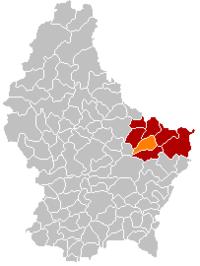 | |
| Coordinates: 49°46′45″N 6°20′15″E / 49.7792°N 6.3375°E | |
| Country | |
| Canton | Echternach |
| Government | |
| • Mayor | Henri Rinnen |
| Area | |
| • Total | 25.72 km2 (9.93 sq mi) |
| Area rank | 35th of 102 |
| Highest elevation | 393 m (1,289 ft) |
| • Rank | 56th of 102 |
| Lowest elevation | 219 m (719 ft) |
| • Rank | 35th of 102 |
| Population (2018) | |
| • Total | 2,005 |
| • Rank | 75th of 102 |
| • Density | 78/km2 (200/sq mi) |
| • Density rank | 76th of 102 |
| Time zone | UTC+1 (CET) |
| • Summer (DST) | UTC+2 (CEST) |
| LAU 2 | LU0001004 |
| Website | consdorf.lu |
Consdorf (Luxembourgish: Konsdref) is a commune and town in eastern Luxembourg. It is part of the canton of Echternach, which is part of the district of Grevenmacher.
As of 2005, the town of Consdorf, which lies in the centre of the commune, has a population of 1,200. Other towns within the commune include Scheidgen.
References
External links
 Media related to Consdorf at Wikimedia Commons