| Clifton | |
|---|---|
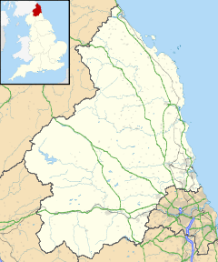
Location within Northumberland | |
| OS grid reference | NZ205825 |
| Unitary authority |
|
| Ceremonial county | |
| Region | |
| Country | England |
| Sovereign state | United Kingdom |
| Post town | MORPETH |
| Postcode district | NE61 |
| Dialling code | 01670 |
| Police | Northumbria |
| Fire | Northumberland |
| Ambulance | North East |
| UK Parliament | |
Clifton is a hamlet in Northumberland, in England.[1][2] The population is between 20 and 30. It is situated a short distance to the south of Morpeth, on the A1. It forms a trio with Hepscott and Glororum, a series of farms founded by the Brown brothers at the end of the 19th century. However, Clifton as a habitation stretches back earlier. In the 12th century lands were held at Clifton, under Roger de Merlay, by William of Clifton.[3] There was a coaching inn here dating from the 17th century.
Governance
Clifton is in the parliamentary constituency of Hexham. It is part of Stannington Civil Parish.
References
- ^ Ordnance Survey: Landranger map sheet 81 Alnwick & Morpeth (Rothbury & Amble) (Map). Ordnance Survey. 2014. ISBN 9780319242094.
- ^ "Ordnance Survey: 1:50,000 Scale Gazetteer" (csv (download)). www.ordnancesurvey.co.uk. Ordnance Survey. 1 January 2016. Retrieved 18 February 2016.
- ^ "Clifton, Northumberlanf". Co-Curate. Retrieved 27 November 2019.
