Wikipedia

Charge Pond

Charge Pond
Location of Charge Pond in Massachusetts, USA.
Charge Pond
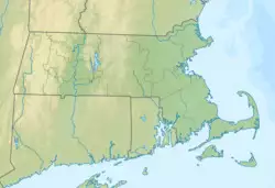
Location of Charge Pond in Massachusetts, USA.
Charge Pond
LocationPlymouth, Massachusetts
Coordinates41°49′00″N 70°40′35″W / 41.81667°N 70.67639°W
TypeLake
Primary inflowsgroundwater
Primary outflowsHarlow Brook
Basin countriesUnited States
Surface area23 acres (9.3 ha)
Average depth6 ft (1.8 m)
Max. depth17 ft (5.2 m)

Charge Pond is a 23-acre (93,000 m2) warm water lake in Plymouth, Massachusetts. The lake has an average depth of six feet and a maximum depth of 17 feet (5.2 m). It is located within a camping area in the southernmost section of Myles Standish State Forest, south of Fearing Pond, southwest of Abner Pond, and northwest of Little Long Pond. The lake is fed by groundwater and is the headwaters to Harlow Brook.

External links

This article is copied from an article on Wikipedia® - the free encyclopedia created and edited by its online user community. The text was not checked or edited by anyone on our staff. Although the vast majority of Wikipedia® encyclopedia articles provide accurate and timely information, please do not assume the accuracy of any particular article. This article is distributed under the terms of GNU Free Documentation License.

Copyright © 2003-2025 Farlex, Inc Disclaimer
All content on this website, including dictionary, thesaurus, literature, geography, and other reference data is for informational purposes only. This information should not be considered complete, up to date, and is not intended to be used in place of a visit, consultation, or advice of a legal, medical, or any other professional.