Chaclacayo | |
|---|---|
) Chaclacayo Street | |
) Flag ) Coat of arms | |
Location of Chaclacayo in the Lima province 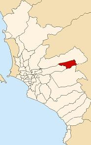 | |
| Coordinates: 11°59′S 76°46′W / 11.983°S 76.767°W | |
| Country | |
| Region | Lima |
| Province | Lima |
| Founded | April 24, 1940 |
| Capital | Chaclacayo |
| Subdivisions | 1 populated center |
| Government | |
| • Mayor | Manuel Campos Sologuren (2019-2022) |
| Area | |
| • Total | 39.5 km2 (15.3 sq mi) |
| Elevation | 647 m (2,123 ft) |
| Population (2017) | |
| • Total | 42,912 |
| • Density | 1,100/km2 (2,800/sq mi) |
| Time zone | UTC-5 (PET) |
| UBIGEO | 150107 |
| Website | munichaclacayo.gob.pe |
Chaclacayo is a district of the Lima Province in Peru.
Location
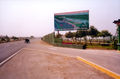
Chaclacayo is located at the 27th km mark of the Carretera Central, the main road headed East starting in the Lima urban center. Borders: North: Rimac River and Lurigancho (Chosica) South: Cieneguilla West: Ate East: Lurigancho (Chosica)
Geography
Chaclacayo is a district in the valley of the Rímac River that runs from the Peruvian Andes to the Pacific Ocean. Its weather is typical of the Coastal Andes: During summertime (from December to February) it is warm and sometimes rainy; the rest of the year it is usually sunny, with average temperatures between 14 and 20 °C. The coldest months are June and July, when temperatures can drop to 12 °C.
Name
The name is derived from an Aymara word that means "at the foot of the carrizo". Carrizo is a plant that grows by the Rimac's riverside.
Main attractions
Places to visit in Chaclacayo are the Parque Central, the central park of the district. Around the park there are other landmarks: a well-known bakery, an Evangelical church, a bazaar, La Oficina de Robin a popular bar, and the Chaclacayo District Council.
River Rimac, open water areas
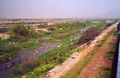
River Rimac, river basin
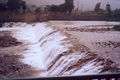
River Rimac, restoration work
)
)
)
Neighborhoods
- Urban Context
- La Floresta
- Alfonso Cobian
- Vírgen de Fátima de Morón
- Huascata
- Miguel Grau
- Villa Rica
- Santa Rosa
- Villa Mercedes
- Santa Ines
- Los Cóndores
- Morón
- Ñaña
- Huascata
- La Tapada
- 3 de Octubre
- Residential Clubs
- El Cuadro
- Los Cóndores
Miscellaneous
The peculiar shape of the district has made some think of Huampaní and Ñaña as being part of Chaclacayo. However those towns belong to the neighboring district of Lurigancho.