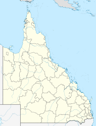
| Carina Heights Brisbane, Queensland | |||||||||||||||
|---|---|---|---|---|---|---|---|---|---|---|---|---|---|---|---|
| Coordinates | 27°30′23″S 153°05′32″E / 27.50639°S 153.09222°E[1] | ||||||||||||||
| Population | 6,732 (2016 census)[2] | ||||||||||||||
| • Density | 1,980/km2 (5,130/sq mi) | ||||||||||||||
| Postcode(s) | 4152[3] | ||||||||||||||
| Area | 3.4 km2 (1.3 sq mi) | ||||||||||||||
| Location | 8 km (5 mi) SE of Brisbane CBD[4] | ||||||||||||||
| LGA(s) | City of Brisbane (Coorparoo Ward)[5] | ||||||||||||||
| State electorate(s) | |||||||||||||||
| Federal Division(s) | Griffith | ||||||||||||||
| |||||||||||||||
Carina Heights is a hill and a suburb of the City of Brisbane, Queensland, Australia. It is located 8 kilometres (5.0 mi) south-east of the Brisbane CBD.[4][6]
Geography
Carina Heights borders Camp Hill, Carina, Carindale, Holland Park, and Mount Gravatt East. The hill itself is at 27°30′02″S 153°05′56″E / 27.5006°S 153.0989°E,[7] and is occupied by the Belmont Private Hospital, a 150-bed mental health facility.[8]
History
Carina Heights is named after the neighbouring suburb Carina, from which it was officially separated in 1975.[4][9]
Carina took its name from an estate on Creek Road constructed in the 1850s. The property belonged to Ebenezer Thorne, and was itself named after Thorne's daughter Kate Carina.[10][11]
The 2011 Census recorded 6,110 residents in Carina Heights.[12]
Street names
A number of street names in Carina Heights are identical to the surnames of former Members of the Queensland Legislative Assembly. These include:
- Buckley Street
- Buzacott Street
- Chataway Street
- Jones Road
- Macalister Street
- Maughan Street
- McGahan Street
- Summerville Street
- Swayne Street
- Wilkinson Street
- Winstanley Street
Some other street names are identical to the surnames of prominent citizens of Brisbane. These include:
- Hecklemann Street
- Whatmore Street - may have been named for George Willoughby Whatmore, a Brisbane motor dealer, yachting official and city councillor.[13] He was, for the four years prior to his death, the owner of the historic home Nyrambla in the suburb of Ascot.[14]
Another group of street names are derived from World War I. They include:
- Anzac Road
- Birdwood Road
- Gallipoli Road
- Mons Road
- Salonica Road
- Vickers Street
Demographics
The 2011 Census recorded 6,110 residents in Carina Heights, of whom 52.5% were female and 47.5% were male. The median age of the population was 35; 2 years below the Australian median.[12]
72.3% of people living in Carina Heights were born in Australia compared to the national average of 69.8%, with the next most common countries of birth being New Zealand (4.3%), England (3.3%), South Korea (1.3%), India (1.1%), and the Philippines (1%). 80.8% of people spoke only English at home; the next most popular languages were Spanish (1.5%), Korean (1.4%), Italian (1.4%), Greek (1%), and Cantonese 0.9%.[12]
References
- ^ "Carina Heights (entry 47602)". Queensland Place Names. Queensland Government. Retrieved 4 January 2014.
- ^ Australian Bureau of Statistics (27 June 2017). "Carina Heights (State Suburb)". 2016 Census QuickStats. Retrieved 13 April 2018.

- ^ "Find a postcode". Australia Post. Archived from the original on 24 August 2011. Retrieved 4 January 2014.
- ^ a b c Centre for the Government of Queensland. "Carina Heights". Archived from the original on 4 January 2014. Retrieved 4 January 2014.
- ^ "Coorparoo Ward". Brisbane City Council. Brisbane City Council. Archived from the original on 4 February 2017. Retrieved 12 March 2017.
- ^ "Carina Heights – hill in the City of Brisbane (entry 6246)". Queensland Place Names. Queensland Government. Retrieved 26 August 2020.
- ^ "Carina Heights – hill in the City of Brisbane (entry 6246)". Queensland Place Names. Queensland Government. Retrieved 26 August 2020.
- ^ "Queensland Globe". State of Queensland. Retrieved 25 August 2020.
- ^ Williams, Brian. "Secrets of Brisbane's suburbs: C". News Ltd. Archived from the original on 22 December 2014. Retrieved 4 January 2014.
- ^ "Carina (entry 42562)". Queensland Place Names. Queensland Government. Retrieved 11 April 2014.
- ^ "Carina". Queensland Places. Centre for the Government of Queensland, University of Queensland. Archived from the original on 27 January 2014. Retrieved 11 April 2014.
- ^ a b c Australian Bureau of Statistics (31 October 2012). "Carina Heights, Qld (State Suburb)". 2011 Census QuickStats. Retrieved 10 October 2013.

- ^ "Obituary - Mr G.W.Whatmore". The Sydney Morning Herald. 1 June 1929. Archived from the original on 18 October 2017. Retrieved 18 October 2017.
- ^ "Nyrambla, Ascot". The Courier-Mail. 4 August 2014. Archived from the original on 18 October 2017. Retrieved 18 October 2017.
External links
- University of Queensland: Queensland Places: Carina Heights
- "Carina/Carina Heights". BRISbites. Brisbane City Council. Archived from the original on 20 July 2008. Retrieved 30 October 2013.
- "Carina Heights". Our Brisbane. Brisbane City Council. Archived from the original on 12 February 2008. Retrieved 30 October 2013.
