Camblain-Châtelain | |
|---|---|
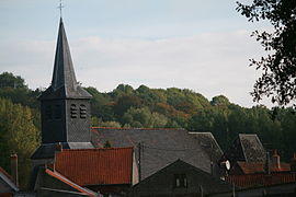
 The church of Camblain-Châtelain | |
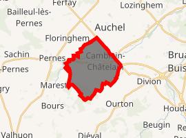
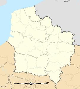
Location of Camblain-Châtelain  | |
| Coordinates: 50°28′58″N 2°27′50″E / 50.4828°N 2.4639°E | |
| Country | France |
| Region | Hauts-de-France |
| Department | Pas-de-Calais |
| Arrondissement | Béthune |
| Canton | Auchel |
| Intercommunality | CA Béthune-Bruay, Artois-Lys Romane |
| Government | |
| • Mayor (2020–2026) | Lelio Pedrini |
| Area 1 | 10.04 km2 (3.88 sq mi) |
| Population (Jan. 2017)[1] | 1,764 |
| • Density | 180/km2 (460/sq mi) |
| Time zone | UTC+01:00 (CET) |
| • Summer (DST) | UTC+02:00 (CEST) |
| INSEE/Postal code | 62197 /62470 |
| Elevation | 51–177 m (167–581 ft) (avg. 85 m or 279 ft) |
| 1 French Land Register data, which excludes lakes, ponds, glaciers > 1 km2 (0.386 sq mi or 247 acres) and river estuaries. | |
Camblain-Châtelain is a commune in the Pas-de-Calais department in the Hauts-de-France region of France.
Geography
Camblain-Châtelain is a farming and light industrial village some 7 miles (11.3 km) southwest of Béthune and 33 miles (53.1 km) southwest of Lille, at the junction of the D341 and the D70 roads, by the banks of the river Clarence.
Population
| Year | 1962 | 1968 | 1975 | 1982 | 1990 | 1999 |
|---|---|---|---|---|---|---|
| Population | 1904 | 1956 | 1880 | 1710 | 1629 | 1581 |
| From the year 1962 on: No double counting—residents of multiple communes (e.g. students and military personnel) are counted only once. | ||||||
Places of interest
- The church of St.Vaast, dating from the fifteenth century.
- Ruins of an 11th-century castle.
See also
References
- ^ "Populations légales 2017". INSEE. Retrieved 6 January 2020.


