| Cairo Road | |
|---|---|
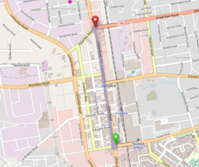
 Map showing Cairo Road through Lusaka | |
| Highway system | |
| Transport in Zambia |
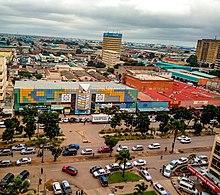
Cairo Road is the main thoroughfare of Lusaka, Zambia and the principal business, retail and services centre of the city. It was a section of the Great North Road and was so named because it is a link in Cecil Rhodes' then dream of a Cape to Cairo Road through British colonies in Africa.
Cairo Road is 1.8 km long, running north-south between the Great East Road and Independence Avenue, and is a wide dual carriageway with an avenue of trees down the centre. It runs parallel to the main railway line which is one block to the east. As the main north-south road it became very congested. This has been partially alleviated by the expansion of Lumumba Road to the west as a by-pass, taking much through traffic. All Heavy Goods vehicles are required to use Lumumba Road.
Despite this, Cairo Road frequently becomes very congested, as does much of Lusaka. This is primarily due to the lack of any major ring roads and the growth of Lusaks's population.
