Bangar | |
|---|---|
Village | |
| Coordinates: 4°42′30″N 115°4′25″E / 4.70833°N 115.07361°E | |
| Country | Brunei |
| District | Temburong |
| Mukim | Bangar |
| Area | |
| • Total | 10 km2 (4 sq mi) |
| Population (2008) | |
| • Total | 3,970 |
| • Density | 400/km2 (1,000/sq mi) |
| Time zone | UTC+8 |
| Postcode | PA1151, PA1351 |
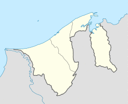
Bangar is the town of the Bruneian district of Temburong,[1] an isolated territorial exclave separated from the rest of the country by the Malaysian state of Sarawak. Although Bangar is officially known in Malay as Pekan Bangar (literally 'Bangar Town'),[2][3][1] it is a village-level subdivision under the mukim or subdistrict of the same name.[4] The postcodes for Bangar include PA1151 and PA1351.[4]
Geography
The town is in the Mukim Bangar (sub-district) of Temburong District. The population is 3,970 inhabitants.
One main road runs through the town, roughly east–west. Headed east of Bangar is Lawas, Sarawak (Malaysia) and to the west is the river crossing to Limbang, Sarawak (Malaysia). The road is the major route to the local quarry where boulders are collected, processed and shipped to stockyards in the capital, Bandar Seri Begawan, for construction companies.
Climate
Bangar has a tropical rainforest climate (Af) with heavy to very heavy rainfall year-round.
| Climate data for Bangar | |||||||||||||
|---|---|---|---|---|---|---|---|---|---|---|---|---|---|
| Month | Jan | Feb | Mar | Apr | May | Jun | Jul | Aug | Sep | Oct | Nov | Dec | Year |
| Average high °C (°F) | 30.1 (86.2) | 30.0 (86.0) | 30.7 (87.3) | 31.4 (88.5) | 31.4 (88.5) | 31.4 (88.5) | 31.1 (88.0) | 31.0 (87.8) | 31.1 (88.0) | 30.8 (87.4) | 30.6 (87.1) | 30.5 (86.9) | 30.8 (87.5) |
| Daily mean °C (°F) | 27.1 (80.8) | 27.0 (80.6) | 27.4 (81.3) | 28.0 (82.4) | 28.0 (82.4) | 27.9 (82.2) | 27.6 (81.7) | 27.6 (81.7) | 27.6 (81.7) | 27.5 (81.5) | 27.3 (81.1) | 27.3 (81.1) | 27.5 (81.5) |
| Average low °C (°F) | 24.1 (75.4) | 24.1 (75.4) | 24.2 (75.6) | 24.6 (76.3) | 24.7 (76.5) | 24.5 (76.1) | 24.2 (75.6) | 24.2 (75.6) | 24.2 (75.6) | 24.2 (75.6) | 24.1 (75.4) | 24.2 (75.6) | 24.3 (75.7) |
| Average rainfall mm (inches) | 380 (15.0) | 258 (10.2) | 258 (10.2) | 310 (12.2) | 360 (14.2) | 278 (10.9) | 298 (11.7) | 294 (11.6) | 385 (15.2) | 389 (15.3) | 410 (16.1) | 392 (15.4) | 4,012 (158) |
| Source: Climate-Data.org[5] | |||||||||||||
Sister cities
References
- ^ a b "Temburong District" (PDF). www.information.gov.bn. p. 8. Retrieved 2018-02-28.
- ^ Brunei Darussalam street directory : quick & easy reference maps., Brunei Press Sdn. Bhd., 2014, pp. 188–189 & 198–199, ISBN 9789991732411, OCLC 932264901
- ^ "Jabatan Daerah Temburong, Kementerian Hal Ehwal Dalam Negeri - MUKIM BANGAR". temburong.gov.bn (in Malay). Retrieved 2018-02-28.
- ^ a b "Brunei Postal Services - postcodes". post.gov.bn. Retrieved 2018-02-28.
- ^ "Climate: Bangar". Climate-Data.org. Retrieved August 12, 2020.
External links
 Bangar travel guide from Wikivoyage
