Authevernes | |
|---|---|
) Fort | |
.svg.gif')) Coat of arms | |
Location of Authevernes 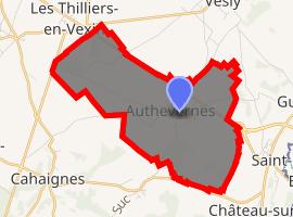 | |
) Authevernes ) Authevernes | |
| Coordinates: 49°13′09″N 1°38′25″E / 49.2192°N 1.6403°E | |
| Country | France |
| Region | Normandy |
| Department | Eure |
| Arrondissement | Les Andelys |
| Canton | Gisors |
| Intercommunality | CC Vexin Normand |
| Government | |
| • Mayor (2014-2020) | James Blouin |
| Area 1 | 8.15 km2 (3.15 sq mi) |
| Population (Jan. 2017)[1] | 400 |
| • Density | 49/km2 (130/sq mi) |
| Time zone | UTC+01:00 (CET) |
| • Summer (DST) | UTC+02:00 (CEST) |
| INSEE/Postal code | 27026 /27420 |
| Elevation | 68–148 m (223–486 ft) (avg. 140 m or 460 ft) |
| 1 French Land Register data, which excludes lakes, ponds, glaciers > 1 km2 (0.386 sq mi or 247 acres) and river estuaries. | |
Authevernes is a commune in the Eure department in Normandy in northern France.
Population
| Year | Pop. | ±% |
|---|---|---|
| 1962 | 137 | — |
| 1968 | 180 | +31.4% |
| 1975 | 202 | +12.2% |
| 1982 | 225 | +11.4% |
| 1990 | 273 | +21.3% |
| 1999 | 361 | +32.2% |
| 2008 | 396 | +9.7% |
| 2015 | 390 | −1.5% |
See also
References
- ^ "Populations légales 2017". INSEE. Retrieved 6 January 2020.