Alcantara | |
|---|---|
| Municipality of Alcantara | |
) Alcantara, Cebu – National road | |
) Map of Cebu with Alcantara highlighted | |
OpenStreetMap 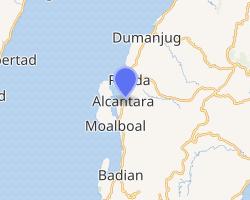 | |
.svg.gif')) Alcantara Location within the Philippines | |
| Coordinates: 9°58′18″N 123°24′17″E / 9.971533°N 123.404678°E | |
| Country | |
| Region | Central Visayas (Region VII) |
| Province | Cebu |
| District | 7th District |
| Founded | 1830 |
| Barangays | 9 (see Barangays) |
| Government | |
| • Type | Sangguniang Bayan |
| • Mayor | Fritz A. Lastimoso |
| • Vice Mayor | Feliciano B. Ferraren |
| • Representative | Peter John D. Calderon |
| • Electorate | 11,228 voters (2019) |
| Area | |
| • Total | 35.20 km2 (13.59 sq mi) |
| Elevation | 47 m (154 ft) |
| Population (2015 census) [3] | |
| • Total | 15,160 |
| • Density | 430/km2 (1,100/sq mi) |
| • Households | 3,416 |
| Economy | |
| • Income class | 5th municipal income class |
| • Poverty incidence | 33.55% (2015)[4] |
| • Revenue | ₱49,407,240.28 (2016) |
| Time zone | UTC+8 (PST) |
| ZIP code | 6033 |
| PSGC | |
| IDD : area code | +63 (0)32 |
| Climate type | tropical rainforest climate |
| Native languages | Cebuano Tagalog |
Alcantara, officially the Municipality of Alcantara (Cebuano: Lungsod sa Alcantara; Tagalog: Bayan ng Alcantara), is a 5th class municipality in the province of Cebu, Philippines. According to the 2015 census, it has a population of 15,160 people. [3]
Alcantara is bordered to the north by the town of Ronda, to the west is the Tañon Strait, to the east is the town of Argao, and to the south is the town of Moalboal.
Barangays
Alcantara comprises 9 barangays:
| ||||||||||||||||||||||||||||||||||||||||||||||||||||||||||||||||||||||||||||||||||||

Climate
| Climate data for Alcantara, Cebu | |||||||||||||
|---|---|---|---|---|---|---|---|---|---|---|---|---|---|
| Month | Jan | Feb | Mar | Apr | May | Jun | Jul | Aug | Sep | Oct | Nov | Dec | Year |
| Average high °C (°F) | 29 (84) | 30 (86) | 31 (88) | 32 (90) | 31 (88) | 30 (86) | 30 (86) | 30 (86) | 30 (86) | 29 (84) | 29 (84) | 29 (84) | 30 (86) |
| Average low °C (°F) | 23 (73) | 22 (72) | 23 (73) | 24 (75) | 25 (77) | 25 (77) | 24 (75) | 24 (75) | 24 (75) | 24 (75) | 24 (75) | 23 (73) | 24 (75) |
| Average precipitation mm (inches) | 42 (1.7) | 34 (1.3) | 40 (1.6) | 61 (2.4) | 124 (4.9) | 188 (7.4) | 190 (7.5) | 191 (7.5) | 189 (7.4) | 186 (7.3) | 124 (4.9) | 73 (2.9) | 1,442 (56.8) |
| Average rainy days | 10.0 | 8.5 | 9.5 | 12.8 | 22.3 | 26.8 | 28.4 | 27.9 | 27.3 | 27.6 | 20.5 | 13.1 | 234.7 |
| Source: Meteoblue [6] | |||||||||||||
Demographics
)
Alcantara public market
| Year | Pop. | ±% p.a. |
|---|---|---|
| 1903 | 4,698 | — |
| 1918 | 5,958 | +1.60% |
| 1939 | 5,754 | −0.17% |
| 1948 | 5,771 | +0.03% |
| 1960 | 5,625 | −0.21% |
| 1970 | 6,866 | +2.01% |
| 1975 | 7,752 | +2.46% |
| 1980 | 7,882 | +0.33% |
| 1990 | 9,559 | +1.95% |
| 1995 | 10,224 | +1.27% |
| 2000 | 11,532 | +2.61% |
| 2007 | 13,036 | +1.71% |
| 2010 | 13,556 | +1.43% |
| 2015 | 15,160 | +2.15% |
| Source: Philippine Statistics Authority [3] [5] [7] | ||
References
- ^ Municipality of Alcantara | (DILG)
- ^ "Province: Cebu". PSGC Interactive. Quezon City, Philippines: Philippine Statistics Authority. Retrieved 12 November 2016.
- ^ a b c d Census of Population (2015). "Region VII (Central Visayas)". Total Population by Province, City, Municipality and Barangay. PSA. Retrieved 20 June 2016.
- ^ "PSA releases the 2015 Municipal and City Level Poverty Estimates". Quezon City, Philippines. Retrieved 12 October 2019.
- ^ a b Census of Population and Housing (2010). "Region VII (Central Visayas)". Total Population by Province, City, Municipality and Barangay. NSO. Retrieved 29 June 2016.
- ^ "Alcantara: Average Temperatures and Rainfall". Meteoblue. Retrieved 9 May 2020.
- ^ Censuses of Population (1903–2007). "Region VII (Central Visayas)". Table 1. Population Enumerated in Various Censuses by Province/Highly Urbanized City: 1903 to 2007. NSO.
External links